Monday 3 September 2001 Since the popular service was introduced nearly two years ago, the free radar images and loops have extended only 128km from each radar unit, while subscribers have enjoyed theoretical coverage out to 512km. Radar is now freely available out to 256km, with both static images and four-image loops available for most Australian radar locations. Subscribers can also access the 256km images, and get new seven-image 256km loops. In addition, images are available from 10 radar sites not available on the free service. These are at:
While all except the Coffs Harbour and Rockhampton sites nearly duplicate other locations, they will be a boon when severe weather or technical problems knock out a nearby installation. Sydney subscribers can also access 64km images and loops from Sydney's main Letterbox radar and from Kurnell, while Townsville residents get an exclusive 32km radar set. Thursday 16 August 2001Bureau opens radar browsing service
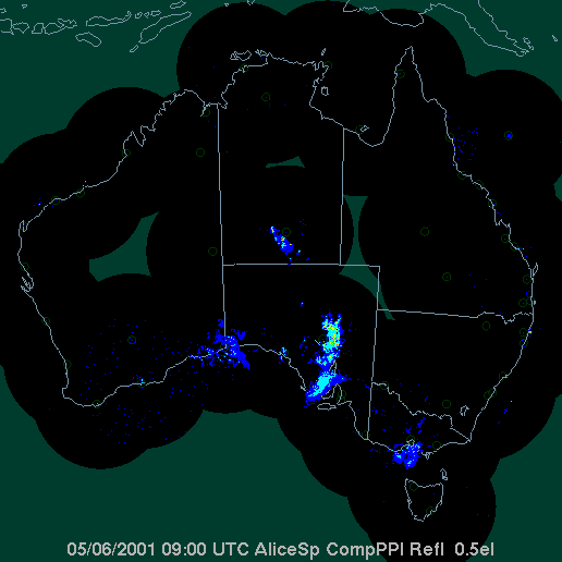
The Bureau of Meteorology has added a radar archive browsing service to its range of chart and satellite archive browsers. The archive allows you to animate sequences of hourly national radar composite images. They are available from 30 March 2001 up to the end of the previous month, with each new month's archive added in the first week of the next month. One image per hour, on the hour, is given, and can be looped up to 2 days (48 images). It gives an interesting new perspective on radar, and on rainfall systems. Click here to visit. Sunday 29 July 2001 Following the popularity of its free radar service, the Bureau of Meteorology plans on doubling the radius of coverage for each site from September this year. Free radar images at present cover out to 128km from each radar installation. The new service will see this extended to 256km, with both looped and static images available as at present. While subscribers to the Bureau's registered service receive images out to 512km, the Bureau regards the quality of coverage beyond 256km to be unsatisfactory unless the rainfall reflections are carefully interpreted. Meanwhile, registered users will see changes to radar loops at 128 and 512km radius from 1 August 2001. These currently use animated gif images to provide one hour of 7 ten-minute image loops. From 1 August, the loop system will be JavaScript driven and in a similar format to the free radar loop service, with the added capacities to change loop speed and direction, and measure distances and bearings. Monday 2 July 2001 Some bad news for southern ocean watchers -- especially those looking for cold outbreaks surging up from the south -- as well as for Bureau of Meteorology forecasters. From Wednesday 4 July at 11am EST, GMS-5, the Japanese geostationary satellite that provides Australia with its main operational satellite imagery, will be reducing its availability to cover only as far south as 49°S (about 700km south of Hobart), while the number of transmissions daily will be nearly halved, from 28 to 16. Japan's Geostationary Meteorological Satellite (GMS) program is a key part of the Global Observing System of the World Meteorological Organization. For over two decades GMS cloud images have been of vital importance to the operations of national meteorological services especially in the Asia-Pacific region, including the Australian Bureau of Meteorology. GMS-5 is now operating beyond its design life, as its expected replacement, the Multi-functional Transport Satellite (MTSAT-1) was lost in a launch failure late in 1999. The new replacement, MTSAT-1R, is not expected to be operational until early in 2003. Most of GMS-5's subsystems are in excellent condition, however the Japan Meteorological Agency (JMA) has advised that lubrication buildup is hampering the operation of the southernmost portion of the satellite's scanning mirror mechanism, used to generate full-disk cloud images of the earth. Reducing the number and extent of scans is a precaution to extend GMS-5's usable life. While the present hourly scans will continue for the northern hemisphere, full disk scans, which include the southern hemisphere down to 49°S, will be made only 3-hourly from 00 UTC. Additional images, one hour and half an hour before the 00, 06, 12 and 18 UTC images, will continue to be made to allow upper winds to be calculated through computer tracking of cloud movement on 3 successive images. The main impact will be loss of Southern Ocean satellite data south of Australia, where only strip images from NOAA polar orbiting satellites will be available once or twice a day. Geostationary satellites to the west and east of GMS-5 will be of limited assistance. The Indian Ocean satellite, Meteosat-5, covers westwards from the longitude of the WA/SA border to Africa, while the US GOES West satellite covers from the western Tasman eastwards to South America. The resolution of cloud images southwest and southeast of Australia on these two satellites is close to the edge of curvature. For the Bureau of Meteorology, the main difficulty will be tracking the movement and strength of the deep Southern Ocean low pressure systems and fronts, and judging the timing and impact of winter cold outbreaks and summer cool changes. The information on cloud patterns, and the wind and temperature data that GMS-5 feed into global computer forecast models from this data-sparse area, have made an important contribution to improving forecast accuracy in Australia. The Bureau expects the impact to be relatively small. A statement issued on its website today says "There is almost certain to be some impact on the quality of forecasting services due to the reduction in availability of satellite data. This will be relatively small for the current reduction in coverage and frequency, but if the satellite were to fail completely, the impact would be much more significant. "It is important to remember however that many other types of data are also used in weather forecasting and warning services, so the latter are by no means entirely dependent on satellite-derived information. The aspects of services likely to be affected most are the positioning of tropical cyclones well off the coast and the timing of summertime cool changes in southern Australia. In addition the daily solar radiation service will be disrupted." For a short introduction to geostationary satellites, see the Dundee Satellite Receiving Station faq. For links to technical detail, and comprehensive satellite image links, visit David Baron's International Weather Satellite Images site. Thursday 23 May 2001 The Bureau of Meteorology's website is sporting a new, crisp design from yesterday. An elegant tab design now helps users easily navigate up, down and across the large and complex site. The introduction of radar has made the site one of the most visited in Australia, with around 11 million hits in a busy weather week, up from around 3.5m hits early last year. Two major practical improvements, however, are buried rather deeply below the Hydrology tab. Last year, the Queensland Flood Warning Centre of the Bureau developed an easy to navigate graphical interface for real-time distribution of flood and rainfall information. Its statewide map showing flood levels, and colour-coded rainfall totals for the past hour, the latest 24 hours to 9am, and the period since 9am, made it easy to locate where flooding or heavy rain was occurring, then zoom in on the area of interest for specific information. This prototype has become the basis for similar maps in all other states and the Northern Territory. District maps are available for Queensland, New South Wales, the Northern Territory and Western Australia and are coming for the other states. So far, only Queensland provides detailed flood histories and flood warning system descriptions and maps for each river basin. Sydney, Brisbane and Adelaide have special pages showing rainfall for each of the past 6 hours, as well as since 9am and for the previous 24 hours, and the presence of JavaScript under the individual station buttons suggests that station data may soon be available interactively. River conditions are colour-coded as below minor, minor, moderate or major, with links to relevant warnings and tabulated river level data. There are also links to radar and notable historical heavy rainfall information for most states. Perhaps one of the most useful areas of the new sub-site, both in times of flood and during less intense rainfall, is the tabulated data showing detailed rainfall by river basin. This is currently only available for Queensland and NSW. There are three tables for each district: one showing hourly rainfall for each of the past 8 hours, a second showing 3-hourly totals for the day to date, and a third showing 24-hour totals for the past week along with the total since 9am today. These make it easy to see the intensity and chronological shape of rainfall in each river basin. The links are rather well hidden at the foot of each district map. Rainfall information is gathered from the Bureau's extensive manual and telemetered raingauge network, as well as other agencies. Australian Weather News has developed a set of links to allow easy browsing of both the maps and rainfall data, and these will be extended as the Bureau's flood warning service expands. Thursday 23 May 2001 The Federal Government continued its program of additional funding for the Bureau of Meteorology in last Tuesday's Budget. $3m has been allocated for three new radar installations, at Bowen Qld, Yarrawonga Vic, and Captains Flat to improve radar coverage in the Canberra area. Free web radar will be extended to a radius of 256km from all radar installations, compared to the current 128km. Under the initiative aimed at enhancing the services to provincial cities and rural areas, which has been underway since 1996, the Budget allocated $350,000 for the 2001-02 year for the development of new forecast and information products, and improved product coverage in regional Australia. Main details of the $212.5m allocation to the Bureau are:
Friday 30 March Yarrawonga Airport was announced yesterday as the location for Weather Watch radar station in Victoria. Radar users will be aware that central and northeastern Victoria currently lie in a shadow area for existing radar installations at Sale, Melbourne, Mildura and Wagga. The unit is expected to be operational about March 2002. It will be of most benefit in tracking severe storms and flood-producing rain events, to which the area is particularly prone. The area covered by the radar is a major fruit-growing and cropping area that will welcome the advance notice of hail given by radar. The unit will be a new C-band 5cm wavelength radar, which has a range out to between 200 and 300km. While the Bureau's current policy is to make only 128km range radar freely available, potential users outside this range will be able to subscribe to receive the images. The Bureau's Radar Engineering Branch web pages carry technical information about the Weather Watch radar service. Friday 30 March The Bureau of Meteorology's Annual Report for 1999/2000, issued October 2000, is now available on the Bureau's site. At a hefty 32 megabytes and 232 pages, it's not everyone's bedtime reading, but an overview and other individual parts can be separately downloaded. Also new on the Bureau's site is their Corporate Strategy for 1999-2004. This document sets out the Bureau's broad corporate vision and goals following the Government's acceptance of the 1996 Slatyer Review into the operation of the Bureau, but in the context of continuing uncertainty over Bureau funding and charging policies. To this end, there is perhaps more written between than in the lines of the Capturing New Opportunities section, with the Government's response to the second Slatyer report of January 1997 unknown. In addition, an independent strategic assessment of the Bureau's operating environment and organisational structures and processes is expected to have major impacts on the Bureau's future planning. This strategic review is nearing completion, with drafts currently being considered by the Bureau executive and the Parliamentary Secretary to the Minister for the Environment, Dr Sharman Stone, who has special responsibility for the Bureau. Saturday 24 March The Bureau of Meteorology celebrated World Meteorological Day, and this the International Year of Volunteers, by recognising the thousands of Australians that provide voluntary weather observations around the country each day. In a ceremony at the Bureau's Head Office in Melbourne last Thursday, Dr Sharman Stone, Parliamentary Secretary to the Minister for the Environment and Heritage, presented certificates of recognition to representatives of five groups of volunteers. Dr Stone has particular responsibility for the Bureau of Meteorology. While the backbone of the daily weather observational routine is provided by paid observers and Bureau staff, the detail is provided by thousands of voluntary observers who measure rainfall and river heights daily, and storm spotters who give the Bureau on-the-ground feedback when severe weather threatens. Less well known are the crews of ships that voluntarily provide full synoptic observations to the Bureau and the international meteorological community every 3 or 6 hours, and the voluntary contributions to the Bureau's research programs by retired meteorologists. "More than 6200 Australians volunteer to take rainfall observations for the Bureau each day. Many continue a time-honoured family tradition that in some cases stretches back five generations and 150 years," Dr Stone said. Rainfall observers were represented in Melbourne by Ros Brown of Warburton East, who for 19 years has been recording rainfall near the Upper Yarra Dam - a part of Melbourne's water supply network. "Many thousands of volunteers also make up the Bureau's storm spotters network that aids in the provision of timely weather warnings. When time is critical, the spotters report to forecasters on sometimes deadly and costly thunderstorms, on occasion chase the storms, and report on the aftermath", Dr Stone said. Storm spotters were represented in Melbourne by Dr Julian Hollis of Trentham and Clyve Herbert of Leopold. Dr Hollis, Mr Herbert and a network of
storm spotters in western Victoria not only provide forecasters with
first-hand information on heavy rain, lightning and hail, they also
watch for "It is possible to get a severe storm warning put out by the Bureau based on what seems to be beginning to happen up our way," Dr Hollis says. There are similar networks active in other states. Volunteer river height observers, like rainfall observers, sometimes have generations of experience at watching river heights to assist the Bureau in issuing flood warnings and to monitor Australia's water resources. River height observers were represented in Melbourne by John Warden of Oberon and Cath Bell of Yetman, both in NSW. Volunteers at sea were represented in Melbourne by Captain Ian French of the P&O Nedlloyd/Swires ship Arafura and Brian Warburton, representing the CMA/CGM Group ship the Australian Endeavour. The Bureau coordinates observations from about 84 foreign and Australian-owned ships. Captain French says most sailors are more than happy to do their bit for the Bureau, simply because "as we're an end-user of the forecast, it's beneficial for us to contribute to the accuracy of the forecast". The observations - air pressure and temperature, humidity, sea-surface temperature, windspeed and direction, and visual observations such as wave heights - are sent to the Bureau every six hours along with the position of the ship. The routine takes about 15 minutes to perform. Some retired Bureau scientists also continue to assist researchers in unravelling the mysteries of the weather, comparing the findings of more traditional methods of forecasting with techniques involving atmospheric models run on supercomputers. Research volunteers were represented by retired meteorologist Henry Phillpot of Melbourne, who has spent the 20 years since his retirement working in a voluntary capacity on research into Antarctic weather forecasting. The Bureau also used the occasion to present excellence awards to its own staff, and to announce the presentation of certificates to 54 staffers recognising their 30 years of service to the Bureau. The Bureau's individual excellence award was awarded to Frank Cummings of the Radar Engineering section, who has served the Bureau for more than 20 years. "The popularity of the weather radar website is testament to the dedication of Frank and the radar team at Collingwood in Victoria, and the commitment to providing public access to weather information," Sharman Stone said. Its group excellence award was
presented to staff involved in the development of the Australian Integrated
Forecast System - the Bureau computer system that presents weather observations
and analysis to observers and forecasters, through which warnings and
forecasts are issued. The award was accepted by team leader Chris Ryan. |
 Australian
Weather Industry News
Australian
Weather Industry News