First snow of the season
Good rain in northern Tasmania, but record dry continues in the south
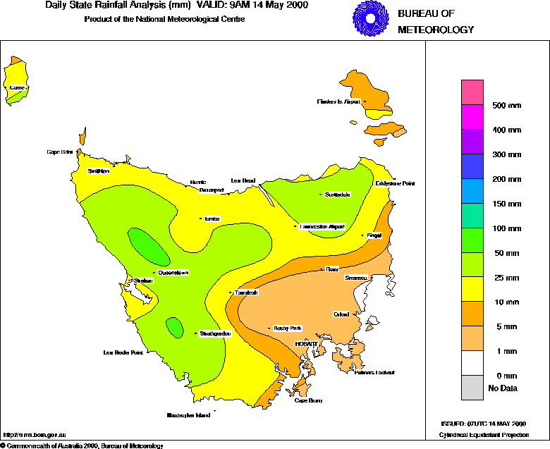 |
| Tasmanian rainfall for the 24 hours to 9am (above), and percentage of normal rainfall for the year to April 2000 (below) |
 |
| Click on graphics to open full-size versions in separate windows. You can then click between windows to make comparisons. |
Unseasonally heavy showers have continued around the Northern Territory Arnhemland coast, giving somewhere in the Wessel Islands a fall of more than 70mm on each of the past three days. Narawili, Elcho Island, recorded 72mm on Friday, Cape Wessel 77mm yesterday, and this morning's reading of 72.6mm at Galiwinku on Elcho Island is the highest May daily rainfall there in over 50 years. The area averages around 25mm in a normal May as the wet season winds down. A middle level trough and converging low level winds sweeping moisture down from the northeast are responsible.
There was rejoicing in the NSW and Victorian ski resorts as the first snowfalls of the season coated the slopes with a light cover of snow. Yesterday's rain turned to snow overnight as colder air moved in behind the low pressure and frontal systems that have brought gales and rain to the continent's southern coast for the past few days. Snowy Mountains and Victorian alpine resorts recorded between 25 and 65mm for the 24 hours to 9am, falling as rain until yesterday evening, then as light snow. Kosciusko Chalet at Charlotte Pass reported a snow depth of 3cm at 9am, and snow fell lightly in Thredbo Village around dawn.
Moderate overnight rain gave northern and northeastern Tasmania some of their best falls in 4 months. 40 to 50mm was recorded along the Tiers and in mountain areas of the northeast, with more general falls of 25 to 40mm. Details are given in the rainfall box below. Unfortunately, most of the agricultural areas in the Derwent Valley west of Hobart received only a few millimetres.
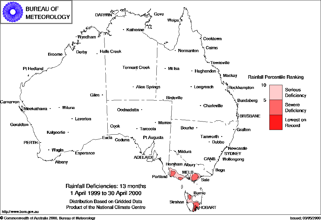
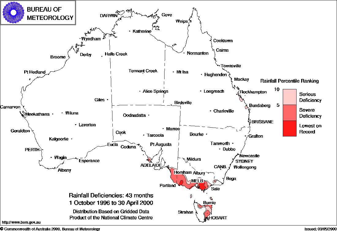
The Bureau of Meteorology's latest drought statement shows that April rainfall across Tasmania was either the lowest on record or in the bottom 10% of April totals. The situation is worst in the southeast, where an area centred on Hobart has experienced 13 consecutive below-average months, and less than 50% of normal rainfall. As shown on the rainfall deficiency map for the past 13 months (below left), the period has been a record dry for the area, whilst serious to severe deficiencies continue elsewhere in the state. There has been a long-term deficiency in these areas, and in neighbouring parts of Victoria and South Australia, as shown on the map (below right) for the past three and a half years.
 |
 |