| Site: Home Daily Weather Summaries Search Feedback About | |
| Weather: Forecasts Current Recent & climate Severe Know-how Mobile |
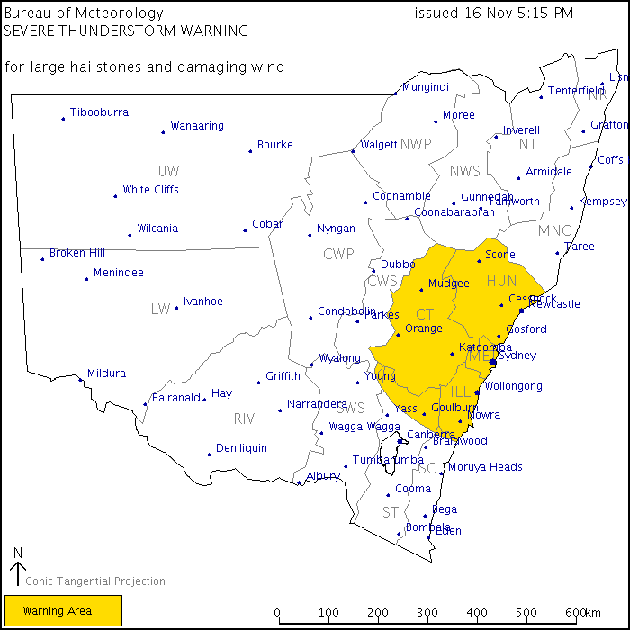
Other archives: 2005 | 2006 | 2007 | 2008 Wednesday 22 December In a first for Australia, the NSW Regional Office of the Bureau is issuing map-based severe thunderstorm warnings for the state, and specific severe storm cell maps for the Greater Sydney area.
While the map-based state warnings add value to current text-based storm warnings, those for the Sydney Metro area are a major innovation. Bureau Regional Director Barry Hanstrum told the Sydney Morning Herald "A picture tells a thousand words. There might be a dozen storms happening but only one or two will be really nasty ones. We are able to pick out the storms that are severe, look at their track and project them forward over the next hour. If you click on our site you will see how big the storm is and where it is heading." The software for the new system was developed by the Bureau's BMRC Research Centre in Melbourne in conjunction with Bureau forecasters in Sydney and has been trialled for two years with the NSW State Emergency Service. An early prototype was tested during the Sydney Olympics. Similar systems are planned for all the Bureau's capital city offices. Brisbane, Adelaide and Melbourne installations are expected during 2005. New Doppler radars to be installed as part of a Federal Government-funded $62.2 million upgrade of Bureau radars across Australia are an important component of the new services. Wednesday 3 November A new weather station located at Fowler's Gap, 100km NNE of Broken Hill NSW, was commissioned on 29 October. It joins Tibooburra, White Cliffs and Wilcannia in providing a climatic record for the sparsely settled Upper Western -- Far Northwest Bureau rainfall district. Thursday 21 October Two significant gaps in the observational network have recently been filled by new automatic weather stations. A new station at Terrey Hills in Sydney's northern suburbs is, surprisingly, providing the first climatic data ever officially recorded north of the Harbour and east of the North Shore Line. This location is also notably higher than any other climatic station in the Sydney basin at an elevation of 199m, and is likely to have a microclimate a little different to either coastal or inland parts of the metro area. A second new AWS will provide weather information from a little-documented part of Tasmania. The rugged and virtually uninhabited South West has only two inland weather stations, both on the shores of Lake Pedder (Strathgordon and Scotts Peak Dam). The new AWS at Warra Creek, is located 480m asl on the eastern slopes of Mt Frederick, about 55km WSW of Hobart. The station is in the middle reaches of the Huon River, and lies midway between Geeveston and the eastern boundary of the South West Wilderness Area. Sunday 5 September Bureau satellite images have had a make-over. Infrared images are now displayed on top of a topographic map of Australia using a system that reduces file size and allows faster download. Infrared imaging measures the temperature (and therefore the approximate height) of the cloud tops that it "sees". The new presentation shows low cloud as a bluish grey, mid-level cloud as different shades of grey and high cloud as white. This is particularly effective in the new four-image loop in discriminating between different cloud levels and types. The images are available on the Bureau's normal satellite image home page, and there's a special page giving details of the new images. Wednesday 25 August The Bureau continued to unveil its policy of providing a more comprehensive free weather service by releasing a broad range of forecast model charts on its website today. The charts, previously only available for a hefty subscription, cover surface and upper air pressure patterns and rainfall up to 8 days ahead. The Bureau's own GASP (Global Analysis and Prediction), LAPS (Limited Area Prediction System) and TLAPS (Tropical LAPS) model output charts are available for the Australian region, SE Asia and the Pacific and Indian Oceans along with a limited number of southern hemisphere and global charts. Some output is also available from the Bureau's higher resolution MESO-LAPS model, though only in charts covering the whole country. All the models are updated twice daily for 00 and 12 UTC (10am and 10pm EST). Surface pressure charts also showing thickness lines are available out to 24 hours for MESO-LAPS, 3 days for LAPS and TLAPS, and 8 days for GASP (though the GASP pressure/thickness charts are currently mislabelled "MSLP" only). Rainfall forecast charts go out to 2 days for MESO-LAPS, 3 days for LAPS and 8 days for GASP. Other charts useful for the keen weather-watcher are the GASP Total-Totals (instability index) and 850hPa temperatures out to 8 days, and LAPS upper air forecasts at 6 levels in the atmosphere. The access page for the new charts is http://www.bom.gov.au/nmoc/NWP.shtml. A feature that the general user will find handy is a colourful 4-day chart loop showing pressure patterns and rainfall (currently mislabelled MSLP/thickness). Mariners will find the 2 day 3-hourly wind forecast loop great for visualising changes in wind speed and direction. An obscure chart that will however interest weather-watchers is the 24 hour isallobar chart, which shows the change in pressure over the past 24 hours. While the current navigational structure and black-and-white charts don't have quite the pizzazz of the US model output available from overseas sites, they show the basics clearly and at last give web-educated weather watchers access to the local alternative from the Bureau's own site. AWN will provide its own set of links to the charts over the next few days. Friday 20 August The Bureau's website provides detailed monthly climatic data for about 1300 locations around Australia in addition to a variety of charts and graphs. The data tables have now been updated to include weather readings up to the beginning of 2004. Measurements included in these very useful tables are average and extreme temperatures and rainfall, sunshine, wind, humidity and evaporation. The links to access these tables are at the bottom of the main climate access page. Friday 13 August Two more automatic weather stations have come online from the Bureau. In VIC, an AWS at Omeo is providing half-hourly reports from the Great Dividing Range to the east of the VIC Alps. Its reports can be found in district 83, the Upper Northeast. In QLD, a new AWS at St Lawrence on the coast halfway between Rockhampton and Mackay is in district 33, Central Coast East, and is providing hourly reports. Thursday 15 July Mount Ginini NSW/ACT: Located 40km SW of Canberra on the NSW/ACT border, the AWS is 2m below the summit of the 1762m high mountain, making it the fourth highest weather station in Australia behind Thredbo Top Station (1957m), Mt Hotham summit (1849m) and Falls Creek (1767m). The new AWS is a collaboration between the Bureau and the ACT Emergency Services Bureau, and follows a recommendation made for an AWS in the Brindabella Ranges by the Inquiry into the Operational Response to the January 2003 Bushfires in the ACT. The station is located in rainfall district 70, the Southern Tablelands -- Goulburn/Monaro. Maria Island TAS: The new AWS on Maria Island is located on Point Lesueur, 15km SE of Orford on the mainland. Point Lesueur is on the western side of the island, facing Mercury Passage and the mainland, and although it is a useful shortcut for small craft, the presence of a 710m peak on Maria Island and country rising to over 500m on the nearby mainland make it an area of tricky winds. The new AWS will build up a climatology for the area and lead to improved forecasts, as well as providing frequent weather reports available to boaties. The station is located in rainfall district 92, the East Coast. Hopetoun Airport VIC: The Hopetoun AWS is in a remote area of the Victorian Mallee, poorly served for weather observations. It is also the first AWS to be acquired by the Bureau from the Victorian Country Fire Authority under an agreement that will see the CFA's small network of AWSs upgraded and added to the Bureau's network. The nearest existing AWS observations come from Nhill, 90km to the SW and Walpeup, 70km NNW. The only other current climatic station in rainfall district 77, Mallee South, is Swan Hill, 120km ENE. Lameroo Airport SA: The new Lameroo AWS is at the airport at Austin Plains, 10km SW of the town, and will replace manual observations taken 3-hourly in the town itself. These have now cut back to twice daily (6 and 9am) and will be phased out when a parallel record of the two stations is established for comparison purposes. Lameroo is in rainfall district 25, Murray Mallee and Upper Southeast. Grove Research Station TAS: Grove is located in the Huon Valley, 20km SW of Hobart. The new AWS will be augmenting rather than replacing the observation program at this agricultural research station, where the weather station is one of only 8 Climate Reference Station in Tasmania. It has high quality records dating back to 1952. Grove is in rainfall district 94, the Southeast. Cowra Airport NSW: As with Lameroo, the new AWS replaces manual observations, though at Cowra these are taken close to the airport and are continuing at present. Cowra is in rainfall district 65, Central Western Slopes -- South. Georgetown Airport QLD: Similar to Lameroo, with the AWS at the airport replacing manual observations at the Post Office in town which are continuing for the present. Georgetown is in rainfall district 30, Upper Carpentaria. Douglas VIC: Another of the former CFA AWSs like that at Hopetoun, the Douglas AWS is located 65km NE of Casterton in district 79, Wimmera South. This AWS is only transmitting half-hourly METAR observations at present, so its reports are only available on the AWN hourly link. Launceston Airport TAS: An AWS replaced the full manual observation routine at the airport mid May, following the replacement of airport met services by a met shopfront information service in Launceston itself. This service is the first of what Dr Sharman Stone, Parliamentary Secretary for the Environment and Heritage with responsiblity for the Bureau, has described as the "first of a kind in Australia". The office, with two staff of which at least one will be a forecaster, will prepare local forecasts, brief media and act as an interface between Bureau services and the local community. "As this is an experiment in extending the [Bureau's] services into the community we will closely monitor the level and type of services sought to ensure the most appropriate level and type of staff required at the Launceston 'shopfront'," Dr Stone said. Launceston is located in rainfall district 91, the North Coast. Tuesday 6 July An index page leads via state pages to a compact set of monthly tables for each weather station, showing maximum and minimum temperatures, rainfall and simplified 9am and 3pm observations for each day of the month. Further links lead to montly tables for the past 13 months. Some stations also provide sunshine, evaporation and wind gust data. Colour coding is used to pick out monthly highs and lows, while averages and totals are given at the bottom of each table. The tables may also be downloaded as csv (comma-delimited) files that can be read into a spreadsheet, or as Acrobat pdf files for easier printing. To visit the index page, go here. Wednesday 30 June Wednesday 30 June Links to each state page are on AWN's Observations Matrix -- click current > Current weather on the web - observations. Thursday 24 June Friday 18 June The first evidence of major changes planned for Bureau of Meteorology forecasts is now visible on the Web. Nationally consistent 4-day coastal waters forecasts are due to be implemented for all states by 1 July, but the Northern Territory has led the pack with its forecasts already in the new format (here). The upgraded forecasts herald wide-ranging changes to Bureau public forecasts over the next year or two. A two-stage Public Weather Forecast Review is well under way within the Bureau with the first stage concentrating on improving existing forecast products and making them nationally consistent. The second stage, looking at potential new products, possibly with public input, will begin when the first stage is substantially complete. National inconsistency among the forecasts issued by different states has become more obvious as the Bureau's website and the needs of private providers such as Weatherzone have exposed the differences to a national audience. A comparison of what's on offer, using AWN's national Forecast Matrix for example, shows variations in the durations of forecasts, the level of detail provided, and the amount of "dumbing down" of forecast commentaries. For example, NSW, SA and WA provide a one-day state forecast while TAS, QLD and VIC provide detailed state outlooks for several days ahead. WA provides individual town forecasts to many centres with less than 2,000 population while in NSW some major centres, such as Springwood with a population of 40,000, receive no specific forecast. A quick flick through the Forecast Notes for each state and territory shows that some are recognise they have a more meteorological savvy audience than others. While some of the differences can be seen as unfair advantages, they are the product of very different meteorological environments and forecast demands. The Bureau has traditionally been a strongly state-based institution, and many of the variations spring from the desire of each state's Regional Forecasting Centre to best meet its local needs. The task of achieving national consistency, therefore, won't be an easy one -- as one Bureau insider put it "we're looking for national consistency with local inconsistency". The Review is timed to have recommendations to the Bureau's Executive by October 2004. Implementation will follow once any concerns raised by any changes have been addressed and the computer document templates that forecasters use to prepare the hundreds of individual forecasts have been developed and trialled. While the Bureau is not seeking public input at this stage, it is consulting groups of stakeholders from which it routinely seeks input as well as the results of regular market research it undertakes. Details on the improvements to the coastal waters forecasts are given here. The most significant are an extension of wind strength and direction forecasts out to 4 days and sea and swell to 2 days (with a planned extension to 4 days). Those who have struggled with the Bureau's typewriter-like text-based forecasts will be glad to see the use of improved formatting, while the use of maps, graphics and tables is under investigation for the future. Curiously, coastal waters forecasts for VIC and QLD will be updated four times daily, while other areas will be updated only twice. |