|
For notes on how to interpret
the data and quality control issues, see Daily Weather Summary Help.
**S** and **W** precede data flagged by the Bureau as suspicious or wrong
Data is as received at 00:18EST, 07/06/2012.
|
|
| |
Max
°
C |
+/- norm
°
C |
Min
°
C |
+/- norm
°
C |
Grass Min
°
C |
Rain to 9am mm |
Evaporation to 9am mm |
Sunshine hours |
Wind Run to 9am km (24-hour average km/h) |
Maximum Gust km/h / hour of occurrence |
| GERALDTON AIRPORT COMPARISON |
28.8 |
-2.8 |
19.4 |
+1.1 |
-- |
0.0 |
-- |
-- |
503 (21.0) |
46/15 |
| PERTH AIRPORT |
31.6 |
-0.1 |
18.0 |
+1.0 |
16.5 |
0.0 |
4.8 |
12.3 |
353 (14.7) |
48/17 |
| ALBANY AIRPORT |
20.6 |
-4.1 |
9.9 |
-3.8 |
6.2 |
0.0 |
3.2 |
1.1 |
262 (10.9) |
28/12 |
| BUNBURY |
27.6 |
-2.0 |
14.3 |
-0.9 |
-- |
0.0 |
-- |
-- |
348 (14.5) |
41/20 |
| MANDURAH |
28.2 |
-0.8 |
18.1 |
-0.5 |
-- |
0.0 |
-- |
-- |
333 (13.9) |
43/20 |
| DARWIN AIRPORT |
34.7 |
+2.9 |
24.2 |
-0.6 |
24.1 |
0.0 |
7.2 |
7.0 |
439 (18.3) |
55/04 |
| ALICE SPRINGS AIRPORT |
40.9 |
+4.5 |
25.2 |
+3.7 |
20.4 |
0.4 |
15.6 |
10.9 |
421 (17.5) |
65/03 |
| WHYALLA AERO |
42.2 |
+12.2 |
26.3 |
+8.8 |
-- |
0.0 |
17.6 |
-- |
411 (17.1) |
61/15 |
| ADELAIDE (KENT TOWN) |
40.6 |
+11.4 |
29.2 |
+12.1 |
-- |
0.0 |
-- |
11.4 |
324 (13.5) |
55/11 |
| MOUNT GAMBIER AERO |
41.7 |
+16.5 |
17.0 |
+5.9 |
13.1 |
0.0 |
10.2 |
11.2 |
323 (13.5) |
70/13 |
| MOUNT ISA AERO |
37.0 |
+0.8 |
22.2 |
-1.5 |
-- |
0.0 |
37.4 |
8.2 |
173 ( 7.2) |
81/16 |
| CAIRNS AERO |
31.5 |
+0.1 |
23.3 |
-0.4 |
20.7 |
5.0 |
8.4 |
11.5 |
485 (20.2) |
43/11 |
| TOWNSVILLE AERO |
32.0 |
+0.7 |
22.3 |
-2.0 |
18.0 |
0.0 |
12.6 |
12.3 |
490 (20.4) |
43/13 |
| MACKAY M.O |
28.8 |
-1.2 |
24.4 |
+0.9 |
-- |
0.0 |
-- |
11.7 |
436 (18.2) |
41/08 |
| ROCKHAMPTON AERO |
30.0 |
-1.9 |
18.9 |
-3.2 |
16.4 |
0.0 |
9.0 |
-- |
333 (13.9) |
39/11 |
| BUNDABERG AERO |
29.2 |
-0.9 |
17.7 |
-3.7 |
-- |
0.0 |
-- |
-- |
486 (20.3) |
48/16 |
| NAMBOUR DPI |
27.0 |
-2.3 |
15.0 |
-4.4 |
-- |
0.0 |
-- |
-- |
-- |
-- |
| COOLANGATTA |
27.6 |
-0.7 |
16.6 |
-4.4 |
-- |
0.0 |
-- |
-- |
312 (13.0) |
37/14 |
| BRISBANE AERO |
27.7 |
-1.3 |
15.8 |
-5.4 |
13.9 |
0.0 |
8.0 |
13.0 |
389 (16.2) |
34/13 |
| TOOWOOMBA AIRPORT |
25.4 |
-2.7 |
14.1 |
-3.4 |
-- |
0.0 |
-- |
-- |
660 (27.5) |
50/07 |
| GUNNEDAH RESOURCE CENTRE |
32.2 |
+0.3 |
16.2 |
-2.7 |
12.3 |
0.0 |
8.0 |
-- |
134 ( 5.6) |
-- |
| COFFS HARBOUR MO |
25.8 |
-1.1 |
15.7 |
-3.7 |
13.9 |
0.0 |
6.4 |
11.6 |
263 (11.0) |
31/12 |
| PORT MACQUARIE AIRPORT AWS |
26.2 |
-1.4 |
13.9 |
-4.3 |
-- |
0.0 |
-- |
-- |
166 ( 6.9) |
37/12 |
| WILLIAMTOWN RAAF |
28.5 |
+0.5 |
13.3 |
-4.7 |
6.9 |
0.02 |
31.4 |
-- |
300 (12.5) |
41/15 |
| GOSFORD (NARARA RESEARCH STATION) AWS |
26.8 |
-0.8 |
12.5 |
-4.3 |
-- |
0.0 |
-- |
-- |
76 ( 3.2) |
28/16 |
| ORANGE AGRICULTURAL INSTITUTE |
28.4 |
+1.9 |
14.0 |
+0.7 |
7.5 |
0.0 |
6.6 |
13.8 |
-- |
-- |
| DUBBO AIRPORT AWS |
34.2 |
+1.1 |
14.8 |
-3.3 |
-- |
0.0 |
-- |
-- |
246 (10.3) |
34/15 |
| SYDNEY AIRPORT AMO |
28.5 |
+2.1 |
18.7 |
-0.1 |
14.4 |
0.0 |
10.2 |
13.2 |
427 (17.8) |
52/18 |
| RICHMOND RAAF |
31.0 |
+1.1 |
14.0 |
-3.6 |
-- |
0.0 |
-- |
-- |
105 ( 4.4) |
30/15 |
| BELLAMBI AWS |
24.5 |
-0.4 |
18.0 |
-1.0 |
-- |
0.0 |
-- |
-- |
439 (18.3) |
50/15 |
| CANBERRA AIRPORT |
32.0 |
+4.0 |
13.0 |
-0.2 |
-- |
0.0 |
-- |
-- |
-- |
-- |
| WAGGA WAGGA AMO |
35.1 |
+3.5 |
17.0 |
+0.8 |
15.1 |
0.0 |
7.8 |
13.4 |
220 ( 9.2) |
28/23 |
| ALBURY AIRPORT AWS |
36.0 |
+3.8 |
17.8 |
+1.1 |
-- |
0.0 |
-- |
-- |
88 ( 3.7) |
24/12 |
| MILDURA AIRPORT |
40.4 |
+8.2 |
22.8 |
+6.1 |
19.7 |
0.0 |
12.8 |
13.4 |
359 (15.0) |
41/08 |
| TATURA INST SUSTAINABLE AG |
38.6 |
+9.1 |
17.6 |
+3.5 |
-- |
0.0 |
-- |
-- |
226 ( 9.4) |
41/15 |
| BENDIGO AIRPORT |
39.0 |
+9.4 |
17.4 |
+3.4 |
-- |
0.0 |
-- |
-- |
207 ( 8.6) |
�
50/14 |
| MELBOURNE REGIONAL OFFICE |
40.0 |
+14.1 |
20.1 |
+5.8 |
-- |
0.0 |
-- |
-- |
-- |
-- |
| BALLARAT AERODROME |
37.4 |
+12.4 |
17.2 |
+6.4 |
-- |
0.0 |
-- |
-- |
488 (20.3) |
57/13 |
| LAUNCESTON (TI TREE BEND) |
28.6 |
+4.3 |
14.2 |
+2.0 |
-- |
0.0 |
-- |
-- |
209 ( 8.7) |
24/11 |
| HOBART AIRPORT |
28.3 |
+5.8 |
15.6 |
+3.6 |
12.2 |
0.0 |
5.6 |
5.5 |
322 (13.4) |
34/22 |
| |
Max
°
C |
+/- norm
°
C |
Min
°
C |
+/- norm
°
C |
Grass Min
°
C |
Rain to 9am mm |
Evaporation to 9am mm |
Sunshine hours |
Wind Run to 9am km |
Maximum Gust km/h / hour of occurrence |
|
| Hottest |
| Highest maximum temperature> | Greatest variation above normal maximum |
Highest minimum temperature | Greatest variation above normal minimum |
44.3 KEITH (MUNKORA) Mallee/Upper SE SA
44.1 BIRDSVILLE AIRPORT Channel Country QLD
44.0 PORT AUGUSTA AERO W Agricultural SA
43.6 MARREE COMPARISON NE Pastoral SA
43.4 ROSEWORTHY AWS Adelaide/Lofty SA
43.4 KEITH Mallee/Upper SE SA
|
+19.9 : 42.6 PORT FAIRY AWS W Coast VIC
+19.2 : 41.9 AIREYS INLET W Coast VIC
+19.1 : 40.2 CAPE NELSON LIGHTHOUSE W Coast VIC
+18.7 : 40.4 PORTLAND (CASHMORE AIRPORT) W Coast VIC
+18.5 : 42.7 WARRNAMBOOL AIRPORT NDB W Coast VIC
|
30.7 BIRDSVILLE AIRPORT Channel Country QLD
30.3 WYNDHAM N Kimberley WA
29.7 WYNDHAM AERO N Kimberley WA
29.4 PORT PIRIE NYRSTAR COMPARISON Lower North SA
29.2 ADELAIDE (KENT TOWN) Adelaide/Lofty SA
|
+12.2 : 26.1 MOUNT CRAWFORD (MT CRAWFORD AWS) Adelaide/Lofty SA
+12.1 : 29.2 ADELAIDE (KENT TOWN) Adelaide/Lofty SA
+11.8 : 29.4 PORT PIRIE NYRSTAR COMPARISON Lower North SA
+11.8 : 28.1 PARAFIELD AIRPORT Adelaide/Lofty SA
+11.6 : 25.1 PARAWA (SECOND VALLEY FOREST AWS) Adelaide/Lofty SA
|
| Coldest |
| Lowest maximum temperature | Greatest variation below normal maximum |
Lowest minimum temperature | Greatest variation below normal minimum |
20.1 THREDBO AWS Snowy Mtns NSW
20.2 MOUNT HOTHAM Upper NE VIC
20.3 JACUP Cent Wheatbelt WA
20.6 ALBANY AIRPORT Lower West WA
20.6 RAVENSTHORPE Cent Wheatbelt WA
|
-8.3 : 20.6 RAVENSTHORPE Cent Wheatbelt WA
-7.1 : 20.3 JACUP Cent Wheatbelt WA
-6.2 : 21.0 ROCKY GULLY Lower West WA
-5.8 : 21.3 MANJIMUP Lower West WA
-5.7 : 24.0 BRIDGETOWN COMPARISON Lower West WA
|
**S** 4.2 BRIDGETOWN COMPARISON Lower West WA
5.9 MURRURUNDI POST OFFICE Hunter Valley NSW
7.5 SCONE AIRPORT AWS Hunter Valley NSW
8.0 MERRIWA (ROSCOMMON) Hunter Valley NSW
8.5 THREDBO VILLAGE Snowy Mtns NSW
|
-9.3 : 5.9 MURRURUNDI POST OFFICE Hunter Valley NSW
-9.3 : 7.5 SCONE AIRPORT AWS Hunter Valley NSW
**S** -8.0 : 4.2 BRIDGETOWN COMPARISON Lower West WA
-7.4 : 9.0 QUIRINDI POST OFFICE NW Slopes S NSW
|
|
Sunniest &
dullest |
Windiest |
Highest gusts |
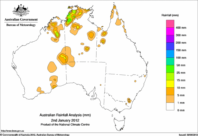
Todays highest rainfall totals for the 24 hours to 9am. It
includes the top 5 totals nationally followed by all reported falls of 50mm or more. |
Highest
and lowest recordings of hours of sunshine for the 24 hours to midnight. |
Highest wind
run totals in kilometres for the 24 hours to 9am (average speed in brackets).
All reported runs >
=25km/h are shown. |
Highest wind
gusts in km/h for the 24 hours to midnight followed by the hour in which it occurred.
All stations with gusts >
89km/h are shown. |
51.0 JINDARE N Rivers NT
50.0 VIOLET VALE STATION S Peninsula QLD
46.6 POINT STUART N Rivers NT
41.0 MIDDLE POINT AWS N Rivers NT
40.6 CHANNEL POINT N Rivers NT
NORTHERN TERRITORY
N Rivers
51.0 JINDARE
46.6 POINT STUART
41.0 MIDDLE POINT AWS
40.6 CHANNEL POINT
QUEENSLAND
S Peninsula
50.0 VIOLET VALE STATION
|
13.8 ORANGE AGRICULTURAL INSTITUTE C Tablelands S NSW
13.6 MOREE AERO NW Plains E NSW
13.4 WAGGA WAGGA AMO SW Slopes S NSW
13.4 MILDURA AIRPORT Mallee N VIC
13.2 SYDNEY AIRPORT AMO Sydney--east NSW
.....
2.7 LAKE LEAKE (ELIZABETH RIVER) E Coast TAS
1.6 CEDUNA AMO W Agricultural SA
1.1 ALBANY AIRPORT Lower West WA
0.5 NORFOLK ISLAND AERO Islands ISL
0.0 LOXTON RESEARCH CENTRE Murray Valley SA
|
894 (37.3) WILLIS ISLAND Islands ISL
861 (35.9) DOUBLE ISLAND POINT LIGHTHOUSE Brisbane/SE Coast QLD
844 (35.2) RUNDLE ISLAND Wide Bay/Burnett QLD
799 (33.3) HAMILTON ISLAND AIRPORT Central Coast E QLD
799 (33.3) CAPE MORETON LIGHTHOUSE Brisbane/SE Coast QLD
774 (32.3) LOW ISLES LIGHTHOUSE N Coast--Barron QLD
759 (31.6) CAPE GRIM BAPS (COMPARISON) N Coast TAS
746 (31.1) LADY ELLIOT ISLAND Wide Bay/Burnett QLD
706 (29.4) HERON ISLAND RES STN Wide Bay/Burnett QLD
687 (28.6) GABO ISLAND LIGHTHOUSE E Gippsland VIC
686 (28.6) BARROW ISLAND AIRPORT W Pilbara WA
682 (28.4) THEVENARD ISLAND W Pilbara WA
679 (28.3) CAPE LEEUWIN Lower West WA
676 (28.2) NEPTUNE ISLAND W Agricultural SA
663 (27.6) ROTTNEST ISLAND Lower West WA
660 (27.5) TOOWOOMBA AIRPORT Darling Downs E QLD
656 (27.3) NORTH ISLAND Central West WA
640 (26.7) CAPE OTWAY LIGHTHOUSE W Coast VIC
637 (26.5) HOGAN ISLAND Islands ISL
626 (26.1) JERVIS BAY (POINT PERPENDICULAR AWS) Illawarra NSW
609 (25.4) GOLD COAST SEAWAY Brisbane/SE Coast QLD
603 (25.1) CLEVE AERODROME W Agricultural SA
|
81/16 MOUNT ISA AERO Gulf Country QLD
81/22 TASMAN ISLAND Southeast TAS
81/09 CAPE WILLOUGHBY Yorke Pen/Kanga Is SA
78/17 CLONCURRY AIRPORT Gulf Country QLD
76/11 STRATHALBYN RACECOURSE Murray Valley SA
76/08 CAPE GRIM BAPS (COMPARISON) N Coast TAS
|
�