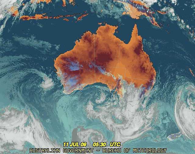
|
For notes on how to interpret
the data and quality control issues, see Daily Weather Summary Help.
**S** and **W** precede data flagged by the Bureau as suspicious or wrong
Data is as received at 04:39EST, 15/05/2012.
|
|
| |
Max
°
C |
+/- norm
°
C |
Min
°
C |
+/- norm
°
C |
Grass Min
°
C |
Rain to 9am mm |
Evaporation to 9am mm |
Sunshine hours |
Wind Run to 9am km (24-hour average km/h) |
Maximum Gust km/h / hour of occurrence |
| GERALDTON AIRPORT |
15.7 |
-3.8 |
10.7 |
+1.2 |
8.2 |
1.2 |
2.2 |
-- |
372 (15.5) |
24/04 |
| PERTH AIRPORT |
17.7 |
-0.2 |
7.2 |
-0.9 |
5.5 |
5.0 |
1.8 |
7.3 |
324 (13.5) |
28/15 |
| ALBANY AIRPORT |
14.0 |
-1.8 |
8.2 |
+0.7 |
6.1 |
10.6 |
1.4 |
4.5 |
399 (16.6) |
35/13 |
| BUNBURY |
15.3 |
-1.9 |
5.4 |
-1.8 |
-- |
0.0 |
-- |
-- |
207 ( 8.6) |
50/03 |
| MANDURAH |
15.8 |
-- |
11.1 |
-- |
-- |
4.6 |
-- |
-- |
358 (14.9) |
31/00 |
| DARWIN AIRPORT |
30.7 |
+0.2 |
18.4 |
-0.8 |
16.0 |
0.0 |
5.8 |
10.7 |
341 (14.2) |
35/14 |
| ALICE SPRINGS AIRPORT |
27.1 |
+7.4 |
9.5 |
+5.5 |
6.0 |
0.0 |
5.0 |
10.3 |
299 (12.5) |
35/11 |
| WHYALLA AERO |
20.6 |
+3.7 |
12.9 |
+7.6 |
-- |
5.0 |
5.0 |
-- |
640 (26.7) |
65/06 |
| ADELAIDE (KENT TOWN) |
17.4 |
+2.1 |
12.1 |
+4.6 |
10.9 |
13.0 |
-- |
2.7 |
458 (19.1) |
50/10 |
| MOUNT GAMBIER AERO |
12.3 |
-0.8 |
9.7 |
+4.5 |
9.2 |
18.8 |
3.2 |
0.0 |
749 (31.2) |
63/04 |
| MOUNT ISA AERO |
27.0 |
+2.3 |
4.6 |
-4.0 |
3.1 |
0.0 |
4.4 |
10.4 |
200 ( 8.3) |
28/09 |
| CAIRNS AERO |
27.4 |
+1.7 |
14.8 |
-2.2 |
11.1 |
0.0 |
7.4 |
9.0 |
447 (18.6) |
35/17 |
| TOWNSVILLE AERO |
25.2 |
+0.1 |
9.0 |
-4.6 |
5.1 |
0.0 |
6.6 |
10.5 |
242 (10.1) |
39/12 |
| MACKAY M.O |
20.8 |
-0.5 |
11.1 |
-1.7 |
-- |
0.0 |
-- |
10.1 |
401 (16.7) |
39/10 |
| ROCKHAMPTON AERO |
24.1 |
+1.0 |
7.3 |
-2.2 |
4.0 |
0.0 |
3.0 |
-- |
165 ( 6.9) |
28/11 |
| BUNDABERG AERO |
21.8 |
-0.2 |
10.6 |
+0.5 |
-- |
0.0 |
5.2 |
-- |
527 (22.0) |
35/10 |
| NAMBOUR DPI |
21.0 |
-0.1 |
13.0 |
+5.3 |
-- |
0.0 |
-- |
-- |
-- |
-- |
| COOLANGATTA |
19.7 |
-0.8 |
13.2 |
+3.3 |
-- |
0.2 |
-- |
-- |
439 (18.3) |
43/10 |
| BRISBANE AERO |
21.4 |
+0.5 |
10.6 |
+1.8 |
8.4 |
0.0 |
3.2 |
8.2 |
428 (17.8) |
35/08 |
| TOOWOOMBA AIRPORT |
16.5 |
-0.1 |
5.6 |
-0.7 |
-- |
0.0 |
-- |
-- |
339 (14.1) |
28/14 |
| GUNNEDAH RESOURCE CENTRE |
17.8 |
+1.7 |
3.7 |
-1.0 |
-1.2 |
0.0 |
3.0 |
-- |
249 (10.4) |
-- |
| COFFS HARBOUR MO |
18.2 |
-0.5 |
12.0 |
+4.5 |
9.6 |
9.0 |
3.8 |
7.1 |
520 (21.7) |
37/08 |
| PORT MACQUARIE AIRPORT AWS |
17.5 |
-1.2 |
8.4 |
+2.1 |
-- |
16.0 |
-- |
-- |
-- |
-- |
| WILLIAMTOWN RAAF |
17.0 |
0.0 |
5.5 |
-0.8 |
3.4 |
1.0 |
1.6 |
5.4 |
292 (12.2) |
28/08 |
| GOSFORD (NARARA RESEARCH STATION) AWS |
16.2 |
-1.3 |
5.7 |
+1.1 |
2.7 |
2.8 |
-- |
-- |
13 ( 0.5) |
13/12 |
| ORANGE AGRICULTURAL INSTITUTE |
11.4 |
+2.1 |
2.6 |
+1.2 |
-1.8 |
0.0 |
1.6 |
3.8 |
-- |
-- |
| DUBBO AIRPORT AWS |
18.2 |
+3.0 |
5.4 |
+2.4 |
-- |
0.0 |
-- |
-- |
388 (16.2) |
35/10 |
| SYDNEY AIRPORT AMO |
17.3 |
+0.3 |
8.7 |
+1.6 |
5.4 |
0.2 |
2.0 |
3.6 |
335 (14.0) |
24/14 |
| RICHMOND RAAF |
16.1 |
-1.3 |
5.0 |
+1.5 |
2.2 |
0.4 |
-- |
-- |
64 ( 2.7) |
17/15 |
| BELLAMBI AWS |
17.4 |
+0.6 |
10.1 |
+0.1 |
-- |
0.2 |
-- |
-- |
212 ( 8.8) |
35/22 |
| CANBERRA AIRPORT |
12.8 |
+1.5 |
3.9 |
+4.0 |
1.4 |
0.0 |
1.0 |
1.3 |
137 ( 5.7) |
22/15 |
| WAGGA WAGGA AMO |
15.2 |
+2.5 |
6.9 |
+4.2 |
3.3 |
0.0 |
1.0 |
0.8 |
274 (11.4) |
28/10 |
| ALBURY AIRPORT AWS |
13.3 |
+0.3 |
4.8 |
+1.6 |
-- |
0.6 |
-- |
-- |
72 ( 3.0) |
24/15 |
| MILDURA AIRPORT |
14.9 |
-0.4 |
10.7 |
+6.4 |
9.4 |
1.8 |
3.6 |
0.7 |
582 (24.3) |
52/00 |
| TATURA INST SUSTAINABLE AG |
11.8 |
-1.2 |
8.2 |
+5.3 |
-- |
4.4 |
-- |
-- |
403 (16.8) |
35/04 |
| BENDIGO AIRPORT |
10.6 |
-1.9 |
6.1 |
+3.7 |
-- |
6.2 |
-- |
-- |
424 (17.7) |
�
44/15 |
| MELBOURNE REGIONAL OFFICE |
14.3 |
+0.9 |
9.3 |
+3.3 |
5.6 |
2.2 |
2.6 |
-- |
225 ( 9.4) |
46/11 |
| GROVEDALE (GEELONG AIRPORT) |
13.7 |
-0.1 |
8.4 |
+3.0 |
-- |
7.0 |
-- |
-- |
477 (19.9) |
74/11 |
| BALLARAT AERODROME |
8.8 |
-1.2 |
6.8 |
+3.6 |
-- |
1.8 |
-- |
-- |
990 (41.3) |
94/10 |
| LAUNCESTON (TI TREE BEND) |
12.4 |
-0.2 |
2.1 |
-0.1 |
-- |
0.2 |
-- |
-- |
62 ( 2.6) |
48/16 |
| HOBART AIRPORT |
12.9 |
+0.5 |
3.8 |
-0.3 |
2.9 |
0.0 |
0.6 |
0.2 |
176 ( 7.3) |
34/11 |
| |
Max
°
C |
+/- norm
°
C |
Min
°
C |
+/- norm
°
C |
Grass Min
°
C |
Rain to 9am mm |
Evaporation to 9am mm |
Sunshine hours |
Wind Run to 9am km |
Maximum Gust km/h / hour of occurrence |
|
| Hottest |
| Highest maximum temperature> | Greatest variation above normal maximum |
Highest minimum temperature | Greatest variation above normal minimum |
33.2 MANGO FARM N Rivers NT
32.9 BRADSHAW N Rivers NT
32.8 CURTIN AERO W Kimberley WA
32.8 OENPELLI N Rivers NT
32.8 JABIRU AIRPORT N Rivers NT
|
+7.5 : 26.5 KULGERA N Plateau NT
+7.4 : 27.1 ALICE SPRINGS AIRPORT N Plateau NT
+6.4 : 25.9 MOOMBA AIRPORT NE Pastoral SA
+6.1 : 28.1 BIRDSVILLE AIRPORT Channel Country QLD
+6.1 : 23.2 WILCANNIA (REID ST) Far Northwest NSW
|
27.0 NORTHERN ENDEAVOUR Islands ISL
24.3 COCOS ISLAND AIRPORT Islands ISL
24.2 HORN ISLAND N Peninsula QLD
24.0 COCONUT ISLAND N Peninsula QLD
23.6 MCCLUER ISLAND N Rivers NT
|
+9.8 : 14.5 TARCOOLA AERO NW Pastoral SA
+8.8 : 13.7 LEIGH CREEK AIRPORT NE Pastoral SA
+8.8 : 11.9 YUNTA AIRSTRIP Northeast SA
+8.7 : 12.5 GLUEPOT RESERVE (GLUEPOT) Northeast SA
+8.6 : 13.1 ROXBY DOWNS (OLYMPIC DAM AERODROME) NW Pastoral SA
|
| Coldest |
| Lowest maximum temperature | Greatest variation below normal maximum |
Lowest minimum temperature | Greatest variation below normal minimum |
0.0 MOUNT HOTHAM Upper NE VIC
1.1 FALLS CREEK Upper NE VIC
1.2 THREDBO AWS Snowy Mtns NSW
1.3 MOUNT BULLER Upper NE VIC
2.1 MOUNT BAW BAW W Gippsland VIC
|
-4.0 : 12.6 SOUTHERN CROSS AIRFIELD Goldfields WA
-3.8 : 15.7 GERALDTON AIRPORT Central West WA
-3.6 : 15.0 BALGAIR Eucla WA
-3.5 : 15.1 FORREST Eucla WA
-3.4 : 14.9 LAVERTON AERO Goldfields WA
|
-4.5 THREDBO AWS Snowy Mtns NSW
-3.5 WOOLBROOK (DANGLEMAH ROAD) NW Slopes S NSW
-3.0 THREDBO VILLAGE Snowy Mtns NSW
-3.0 PERISHER VALLEY SKI CENTRE Snowy Mtns NSW
-3.0 BUTLERS GORGE Central Plateau TAS
|
-6.3 : 8.4 MANGO FARM N Rivers NT
-5.6 : 7.2 DOUGLAS RIVER N Rivers NT
-5.4 : 9.2 TIMBER CREEK N Rivers NT
-5.2 : 8.4 POINT LOOKOUT Brisbane/SE Coast QLD
-4.9 : 8.5 KALUMBURU N Kimberley WA
|
|
Sunniest &
dullest |
Windiest |
Highest gusts |
Todays highest rainfall totals for the 24 hours to 9am. It
includes the top 5 totals nationally followed by all reported falls of 50mm or more. |
Highest
and lowest recordings of hours of sunshine for the 24 hours to midnight. |
Highest wind
run totals in kilometres for the 24 hours to 9am (average speed in brackets).
All reported runs >
=25km/h are shown. |
Highest wind
gusts in km/h for the 24 hours to midnight followed by the hour in which it occurred.
All stations with gusts >
89km/h are shown. |
280.8 INGLEWOOD ALERT
55.4 MAURICETON (JORDAN RIVER) Southeast TAS
40.2 WAROOKA Yorke Pen/Kanga Is SA
40.0 YARROWITCH (MARETTO) N Tablelands E NSW
39.4 PARAWA (SHARON) Adelaide/Lofty SA
SOUTH AUSTRALIA
Yorke Pen/Kanga Is
40.2 WAROOKA
Adelaide/Lofty
39.4 PARAWA (SHARON)
NEW SOUTH WALES
N Tablelands E
40.0 YARROWITCH (MARETTO)
TASMANIA
Southeast
55.4 MAURICETON (JORDAN RIVER)
ISLANDS
280.8 INGLEWOOD ALERT
|
10.8 RABBIT FLAT N Plateau NT
10.7 DARWIN AIRPORT N Rivers NT
10.5 TENNANT CREEK AIRPORT N Plateau NT
10.5 TOWNSVILLE AERO N Coast--Herbert QLD
10.4 BROOME AIRPORT W Kimberley WA
10.4 MOUNT ISA AERO Gulf Country QLD
.....
0.0 MOUNT GAMBIER AERO Lower SE SA
**S** 0.0 WARWICK Darling Downs E QLD
0.0 SCOTTSDALE (WEST MINSTONE ROAD) N Coast TAS
0.0 LAKE LEAKE (ELIZABETH RIVER) E Coast TAS
0.0 STRATHGORDON VILLAGE W Coast TAS
|
1425 (59.4) CAPE WILLOUGHBY Yorke Pen/Kanga Is SA
1425 (59.4) MOUNT READ W Coast TAS
1254 (52.3) DOUBLE ISLAND POINT LIGHTHOUSE Brisbane/SE Coast QLD
1169 (48.7) MOUNT HOTHAM Upper NE VIC
1096 (45.7) MOUNT WELLINGTON Southeast TAS
1060 (44.2) WALLAN (KILMORE GAP) N Central VIC
1050 (43.8) HERON ISLAND RES STN Wide Bay/Burnett QLD
1018 (42.4) NEPTUNE ISLAND W Agricultural SA
1012 (42.2) MOUNT BULLER Upper NE VIC
990 (41.3) BALLARAT AERODROME Western Plains VIC
986 (41.1) HAMILTON AIRPORT W Coast VIC
975 (40.6) COLAC (MOUNT GELLIBRAND) W Coast VIC
913 (38.0) CAPE GRIM BAPS N Coast TAS
907 (37.8) CAPE MORETON LIGHTHOUSE Brisbane/SE Coast QLD
887 (37.0) CAPE JAFFA (THE LIMESTONE) Lower SE SA
885 (36.9) MELBOURNE AIRPORT E Central VIC
880 (36.7) HORSHAM AERODROME Wimmera S VIC
879 (36.6) CLEVE AERODROME W Agricultural SA
844 (35.2) MOUNT CRAWFORD FIRE TOWER Adelaide/Lofty SA
840 (35.0) CAPE LEEUWIN Lower West WA
835 (34.8) YUNTA AIRSTRIP Northeast SA
829 (34.5) HAMILTON ISLAND AIRPORT Central Coast E QLD
829 (34.5) KING ISLAND AIRPORT King Island TAS
825 (34.4) FERNY CREEK (DUNNS HILL) E Central VIC
822 (34.3) CAPE BORDA Yorke Pen/Kanga Is SA
814 (33.9) FALLS CREEK Upper NE VIC
802 (33.4) LUNCHEON HILL (FORESTRY) N Coast TAS
785 (32.7) WILLIS ISLAND Islands ISL
782 (32.6) NORFOLK ISLAND AERO Islands ISL
779 (32.5) MINLATON AERO Yorke Pen/Kanga Is SA
767 (32.0) WARRNAMBOOL AIRPORT NDB W Coast VIC
762 (31.8) LEIGH CREEK AIRPORT NE Pastoral SA
751 (31.3) ROBE AIRFIELD Lower SE SA
749 (31.2) MOUNT GAMBIER AERO Lower SE SA
749 (31.2) LADY ELLIOT ISLAND Wide Bay/Burnett QLD
737 (30.7) TASMAN ISLAND Southeast TAS
731 (30.5) NARACOORTE AERODROME Lower SE SA
730 (30.4) BYRON BAY (CAPE BYRON AWS) North Coast NSW
726 (30.3) MORTLAKE RACECOURSE W Coast VIC
723 (30.1) CAPE NATURALISTE Lower West WA
720 (30.0) COCOS ISLAND AIRPORT Islands ISL
715 (29.8) PORT AUGUSTA AERO W Agricultural SA
702 (29.3) ADELAIDE AIRPORT Adelaide/Lofty SA
696 (29.0) KEITH (MUNKORA) Mallee/Upper SE SA
695 (29.0) ROSEWORTHY AWS Adelaide/Lofty SA
692 (28.8) CAPE FLATTERY N Coast--Barron QLD
690 (28.8) NOARLUNGA Adelaide/Lofty SA
688 (28.7) KUITPO FOREST RESERVE Adelaide/Lofty SA
676 (28.2) WOOMERA AERODROME NW Pastoral SA
661 (27.5) SMITHTON AERODROME N Coast TAS
654 (27.3) STRATHALBYN RACECOURSE Murray Valley SA
647 (27.0) ROTTNEST ISLAND Lower West WA
647 (27.0) COOBER PEDY AIRPORT NW Pastoral SA
647 (27.0) ROXBY DOWNS (OLYMPIC DAM AERODROME) NW Pastoral SA
646 (26.9) ESPERANCE AERO Lower West WA
645 (26.9) RUNDLE ISLAND Wide Bay/Burnett QLD
643 (26.8) ESPERANCE Lower West WA
642 (26.8) STENHOUSE BAY Yorke Pen/Kanga Is SA
640 (26.7) WHYALLA AERO W Agricultural SA
635 (26.5) PADTHAWAY SOUTH Lower SE SA
630 (26.3) PARAFIELD AIRPORT Adelaide/Lofty SA
626 (26.1) PORTLAND (CASHMORE AIRPORT) W Coast VIC
623 (26.0) ESSENDON AIRPORT E Central VIC
623 (26.0) MINNIPA DPI W Agricultural SA
621 (25.9) PORT FAIRY AWS W Coast VIC
619 (25.8) CAPE OTWAY LIGHTHOUSE W Coast VIC
618 (25.8) EDINBURGH RAAF Adelaide/Lofty SA
611 (25.5) HINDMARSH ISLAND AWS Adelaide/Lofty SA
610 (25.4) WUDINNA AERO W Agricultural SA
609 (25.4) THREDBO AWS Snowy Mtns NSW
603 (25.1) HORN ISLAND N Peninsula QLD
602 (25.1) MAROOCHYDORE AERO Brisbane/SE Coast QLD
602 (25.1) CAPE NELSON LIGHTHOUSE W Coast VIC
|
106/10 MOUNT READ W Coast TAS
100/14 FERNY CREEK (DUNNS HILL) E Central VIC
98/22 MOUNT BULLER Upper NE VIC
94/10 BALLARAT AERODROME Western Plains VIC
93/07 WALLAN (KILMORE GAP) N Central VIC
93/08 COLAC (MOUNT GELLIBRAND) W Coast VIC
93/18 MOUNT WELLINGTON Southeast TAS
|
�