Monday 02 NOV 2009
 

Home page

DWS ARCHIVE
2024 2023 2022 2021 2020 2019 2018 2017 2016 2015 2014 2013 2012 2011 2010 2009 2008 2007 2006 2005 2004 2003
Before 2003

About the DWS


2009

Dec

M Tu W Th F Sa Su
  01 02 03 04 05 06
07 08 09 10 11 12 13
14 15 16 17 18 19 20
21 22 23 24 25 26 27
28 29 30 31      

Nov

M Tu W Th F Sa Su
            01
02 03 04 05 06 07 08
09 10 11 12 13 14 15
16 17 18 19 20 21 22
23 24 25 26 27 28 29
30            

Oct

M Tu W Th F Sa Su
      01 02 03 04
05 06 07 08 09 10 11
12 13 14 15 16 17 18
19 20 21 22 23 24 25
26 27 28 29 30 31  

Sept

M Tu W Th F Sa Su
  01 02 03 04 05 06
07 08 09 10 11 12 13
14 15 16 17 18 19 20
21 22 23 24 25 26 27
28 29 30        

Aug

M Tu W Th F Sa Su
          01 02
03 04 05 06 07 08 09
10 11 12 13 14 15 16
17 18 19 20 21 22 23
24 25 26 27 28 29 30
31            

Jul

M Tu W Th F Sa Su
    01 02 03 04 05
06 07 08 09 10 11 12
13 14 15 16 17 18 19
20 21 22 23 24 25 26
27 28 29 30 31    

Jun

M Tu W Th F Sa Su
01 02 03 04 05 06 07
08 09 10 11 12 13 14
15 16 17 18 19 20 21
22 23 24 25 26 27 28
29 30          

May

M Tu W Th F Sa Su
        01 02 03
04 05 06 07 08 09 10
11 12 13 14 15 16 17
18 19 20 21 22 23 24
25 26 27 28 29 30 31

Apr

M Tu W Th F Sa Su
    01 02 03 04 05
06 07 08 09 10 11 12
13 14 15 16 17 18 19
20 21 22 23 24 25 26
27 28 29 30    

Mar

M Tu W Th F Sa Su
            01
02 03 04 05 06 07 08
09 10 11 12 13 14 15
16 17 18 19 20 21 22
23 24 25 26 27 28 29
30 31          

Feb

M Tu W Th F Sa Su
            01
02 03 04 05 06 07 08
09 10 11 12 13 14 15
16 17 18 19 20 21 22
23 24 25 26 27 28  

Jan

M Tu W Th F Sa Su
      01 02 03 04
05 06 07 08 09 10 11
12 13 14 15 16 17 18
19 20 21 22 23 24 25
26 27 28 29 30 31  

Monthly summaries:
from BoM

Find a place:
Google Maps |
Aust Gazetteer|
Geonames

Weather terms:
WeatherZone | BoM |
American Met Soc | NOAA | uk.sci.weather | India Meteorological Department

National Daily Weather Summary

Records set | Charts | Cities | Hottest | Coldest | Rain, sun & wind | Downpours & gales
State extremes | Noteworthy weather | Capital Cities | Regional Cities | Alpine Stations
Charts and data courtesy Bureau of Meteorology. MTSAT-1R operated by JMA
Noteworthy weather today
significant newsworthy major

SA, NSW, VIC: Heatwave continues as cooler change moves in. Temperatures up to 15 above average continued in SA, NSW and VIC today as a cool change moved slowly into southern SA. In Adelaide's northern suburbs, Edinburgh scored a top of 40.4, 14.9 above average, while overnight temperatures in the Adelaide region did not drop below 25. Elsewhere in SA, Whyalla and Keith reported maxima 15.0 above the norm while Port Augusta (42.4), Maree (42.0) and Andamooka (41.7) were the second, third and fourth hottest places in the nation. Maximum temperatures of 41.0 to 41.2 were recorded at Ouyen and Hopetoun in VIC and Minindee, Ivanhoe, Pooncarie and Hay AP in NSW. Overnight, Leigh Creek SA with 28.8 and Broken Hill AP NSW with 27.9 were the second and fourth warmest nationally. Full details are in hottest below.

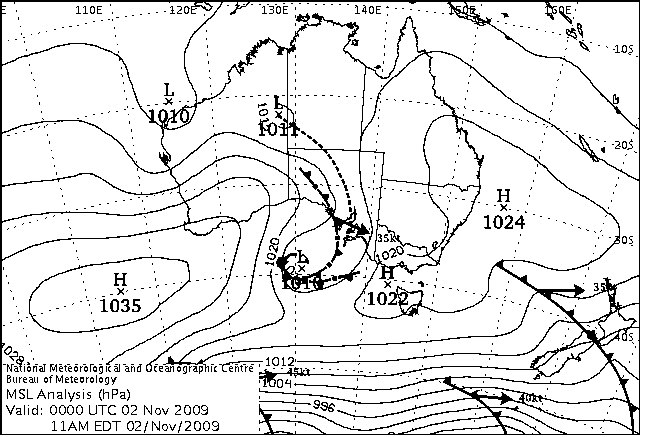
There were gusty winds and heavy thunderstorms ahead of and with the change. Uluru recorded 63mm in a late afternoon thunderstorm that also brought wind gusts to 96km/h. While 63mm was recorded over 3 hours to 6pm, further showers brought Uluru's 24 hour total to 9am Tuesday up to 73.2mm, nearly twice its previous record October one-day fall in 20 years of observations. In Adelaide's east, gusty winds ahead of the change brought down a 20m pine tree in St Georges about 1.40am, narrowly missing a house. The tree in turn brought down a Stobie power pole and 400m of powerlines.

NSW, QLD: Bushfires coming under control. In NSW, a section 44 bushfire emergency has been declared for the Murray Rural fire district providing additional resources to fight a fire 6km east of Mathoura in Moira State Forest that has burnt through over 300 hectares. Cooler weather together with added equipment is expected to help firefighters contain the blaze. In QLD, rain has given firefighters the upper hand in several fires burning in the state. Weekend rain helped extinguish fires around Mt Fox and the Paluma Ranges NW of Townsville while a fire at Tolga on the Atherton Tablelands has also been put out. Also on the Atherton, a large grassfire is burning within containment lines at Mareeba while farther south a bushfire at Wondunna on the Fraser Coast has been brought under control.

International Events

VIETNAM: Tropical Storm Mirinae brings flooding, heavy death toll. Mirinae, downgraded to a tropical storm since it battered the Philippines as a typhoon on 31 October, crossed the coast of central Vietnam this morning bringing winds to 132km/h and dropping nearly 380mm in parts of Phu Yen, Binh Dinh, Quang Ngai, Khanh Hoa and Gia Lai provinces. The number of people known killed by the floods had risen to 98 by 5 November with 20 still missing. A further 2 people were killed across the border in Cambodia. Most of the dead were from the country's easternmost province of Phu Yen. Early reports say over 900 homes were destroyed, 14,000 homes, schools and hospitals unroofed or damaged, 27 fishing boats sunk at wharves, 18,000 hectares of rice and vegetable crops flooded or destroyed, tens of thousands of people stranded by floodwaters, and over 50,000 people evacuated ahead of the flooding. Several villages in Binh Dinh province suffered the worst flooding in four decades after the Ha Thanh River broke its banks while in Phu Yen the flooding is said to be the worst in 30 years after part of the province's system of dykes was overwhelmed. In Binh Dinh, Phu Yen and Gia Lai, floodwater rose to rooftops in some areas. The death and damage follows that inflicted on the country last month by Typhoon Ketsana which killed over 160 people and inundated thousands of homes and tens of thousands of hectares of crops.

UK: Storms and rain bring flooding to eastern Scotland. Storms that brought flooding to Wales yesterday moved to the east of Scotland causing flooding in the Aberdeen area. Grampian Fire and Rescue reported over 350 callouts after the River Deveron burst its banks causing the highest flood levels in the town of Huntly, 70km NW of Aberdeen, since records began in 1959. The River Carron also burst its banks flooding the town centre of Stonehaven, 30km S of Aberdeen, with water chest-high in the high street. The Council Chairman said he had never seen anything like it in the town. Hundreds of people were evacuated across both towns while others had to move to upper storeys of their homes. Roads were closed and people trapped in cars across the Grampians and Tayside, while Arbroath, between Dundee and Aberdeen, was virtually isolated with the main Edinburgh - Aberdeen railway also closed. Landslides occurred near Arbroath and Brechin. 53mm of rain fell in Aberdeen on Sunday, nearly three-quarters the November average. This fell after a wet October in which twice the average rainfall was recorded.


Records set or equalled today

These records are based on data that has been checked for gross errors but has not yet been fully validated. They are based on data received as at 1335 EST on 03/11/2009. Help in interpreting these statistics and information on quality control is here.

District Site Today Previous monthly record Previous all time record
if equalled or broken
Comments
Reading Reading Date Years Reading Date Years
Highest maximum temperature

NT

Darwin-Daly

014142

PIRLANGIMPI

36.2

36.2

22/11/2000

27

1 Equal to record.


The day in charts
Surface charts Satellite images Rain & temperatures
4am EST Rainfall -- 24 hours to 9am
Available about 6.30am EST Available about 4.30am EST Available about 2.15pm EST
Week to 9am | SE AUS detail
10am EST Minimum temperature +/- normal
Available about 12.30pm EST Available about 10.30am EST Available about 2.15pm EST next day
Actual temperatures
4pm EST Maximum temperature +/- normal
Available about 6.30pm EST Available about 4.30pm EST Available about 2.15pm EST next day
Actual temperatures
10pm EST Solar Radiation
Available about 12.30am EST Available about 10.30pm EST Available about 2.15am EST next day

Summary of observations

For notes on how to interpret the data and quality control issues, see Daily Weather Summary Help.
**S** and **W** precede data flagged by the Bureau as suspicious or wrong
Data is as received at 06:56EST, 15/05/2012.

Major centres
Max
° C
+/- norm
° C
Min
° C
+/- norm
° C
Grass Min
° C
Rain to 9am mm Evaporation to 9am mm Sunshine hours Wind Run to 9am km (24-hour average km/h) Maximum Gust km/h / hour of occurrence
GERALDTON AIRPORT 35.6 +8.5 18.8 +5.0 16.0 0.0 13.8 -- 707 (29.5) 61/02
PERTH AIRPORT 26.4 +0.6 10.4 -2.2 8.0 0.0 8.4 12.7 671 (28.0) 54/08
ALBANY AIRPORT 15.5 -5.3 10.2 -0.6 8.1 0.0 4.0 7.8 -- 34/11
BUNBURY 24.8 +0.6 7.0 -5.0 -- 0.0 -- -- 441 (18.4) 41/22
MANDURAH 26.3 -- 11.0 -- -- 0.0 -- -- 477 (19.9) 43/12
DARWIN AIRPORT 34.9 +1.6 25.7 +0.4 25.5 0.0 9.4 11.2 396 (16.5) 37/12
ALICE SPRINGS AIRPORT 38.5 +4.9 25.9 +8.0 22.2 0.0 15.2 11.4 400 (16.7) 65/23
WHYALLA AERO 41.3 +14.8 17.3 +3.4 -- 0.0 8.0 -- 294 (12.3) 72/14
ADELAIDE (KENT TOWN) 37.9 +12.8 22.9 +8.9 22.6 0.0 17.2 8.0 483 (20.1) 65/00
MOUNT GAMBIER AERO 32.7 +12.3 10.5 +2.1 8.2 0.4 2.8 6.9 246 (10.3) 68/16
MOUNT ISA AERO 36.0 -0.4 23.0 +1.6 19.4 0.0 11.8 12.3 377 (15.7) 50/13
CAIRNS AERO 29.1 -1.5 20.4 -1.9 19.7 11.0 10.0 6.1 558 (23.3) 55/15
TOWNSVILLE AERO 29.7 -1.1 21.3 -1.6 18.8 0.0 11.8 12.0 524 (21.8) 50/13
MACKAY M.O 28.1 -1.1 21.5 -0.2 -- 0.0 -- 11.7 417 (17.4) 39/08
ROCKHAMPTON AERO 29.2 -2.0 18.1 -1.4 16.2 0.0 9.2 -- 359 (15.0) 35/10
BUNDABERG AERO 27.8 -0.5 15.4 -3.5 -- 0.0 9.0 -- 422 (17.6) 43/12
NAMBOUR DPI 26.0 -2.0 13.0 -3.3 -- 3.0 -- -- -- --
COOLANGATTA 25.7 -0.1 12.6 -5.6 -- 0.0 -- -- 180 ( 7.5) 31/15
BRISBANE AERO 25.7 -1.1 14.8 -3.2 11.1 0.2 4.6 12.6 276 (11.5) 31/16
TOOWOOMBA AIRPORT 25.7 0.0 11.4 -3.1 -- 0.0 -- -- 526 (21.9) 31/13
GUNNEDAH RESOURCE CENTRE 33.1 +4.8 16.6 +1.6 11.7 0.0 6.6 -- 99 ( 4.1) --
COFFS HARBOUR MO 25.2 +0.3 14.9 -1.2 11.6 0.0 5.6 12.7 347 (14.5) 50/11
PORT MACQUARIE AIRPORT AWS 27.2 +2.3 9.9 -5.1 -- 0.0 -- -- -- --
WILLIAMTOWN RAAF 25.6 +0.2 11.7 -2.6 9.4 0.0 7.2 9.7 265 (11.0) 30/20
GOSFORD (NARARA RESEARCH STATION) AWS 26.8 +1.7 13.9 +0.8 13.1 0.0 -- -- 73 ( 3.0) 24/12
ORANGE AGRICULTURAL INSTITUTE 29.5 +8.4 15.0 +5.9 10.2 0.0 4.0 10.6 -- --
DUBBO AIRPORT AWS 35.1 +6.7 16.4 +2.8 -- 0.0 -- -- 179 ( 7.5) 35/12
SYDNEY AIRPORT AMO 24.9 +0.9 18.4 +3.1 13.2 0.0 7.0 6.9 513 (21.4) 34/06
RICHMOND RAAF 31.8 +5.2 15.8 +1.9 12.1 0.0 -- -- 143 ( 6.0) 41/16
BELLAMBI AWS 24.0 +1.9 17.3 +1.7 -- 0.0 -- -- 342 (14.3) 52/11
CANBERRA AIRPORT 33.3 +10.6 14.7 +5.9 11.9 0.0 8.0 8.9 256 (10.7) 44/17
WAGGA WAGGA AMO 38.5 +12.8 19.1 +8.4 14.6 0.0 8.6 10.3 202 ( 8.4) 31/15
ALBURY AIRPORT AWS 32.4 +6.4 18.7 +7.1 -- 0.0 -- -- 127 ( 5.3) 21/11
MILDURA AIRPORT 40.3 +12.9 22.0 +9.5 18.8 0.2 13.6 11.1 369 (15.4) 55/21
TATURA INST SUSTAINABLE AG 34.0 +9.4 15.0 +4.9 -- 0.0 22.6 -- 311 (13.0) 24/13
BENDIGO AIRPORT 32.8 +8.6 14.7 +5.2 -- 0.0 -- -- 254 (10.6) 39/15
MELBOURNE REGIONAL OFFICE 29.4 +7.5 13.9 +2.7 12.5 0.0 2.8 -- -- --
GEELONG AIRPORT 23.6 +2.6 9.2 -0.4 -- 0.0 -- -- 171 ( 7.1) 57/21
BALLARAT AERODROME 28.2 +8.6 12.2 +4.4 -- 0.0 -- -- 315 (13.1) 50/22
LAUNCESTON (TI TREE BEND) 21.8 +1.4 14.4 +5.5 -- 0.0 -- -- 229 ( 9.5) 37/15
HOBART AIRPORT 18.0 -1.0 8.5 -0.7 5.8 0.0 2.4 9.6 293 (12.2) 35/15
Max
° C
+/- norm
° C
Min
° C
+/- norm
° C
Grass Min
° C
Rain to 9am mm Evaporation to 9am mm Sunshine hours Wind Run to 9am km Maximum Gust km/h / hour of occurrence
Hottest
Highest maximum temperature>Greatest variation above normal maximum Highest minimum temperatureGreatest variation above normal minimum

42.5 EMU CREEK STATION W Gascoyne WA
42.4 PORT AUGUSTA AERO W Agricultural SA
42.0 MARREE COMPARISON NE Pastoral SA
41.7 ANDAMOOKA NW Pastoral SA
41.7 WALUNGURRU N Plateau NT

+14.9 : 39.8 KEITH Mallee/Upper SE SA
+14.8 : 41.3 WHYALLA AERO W Agricultural SA
+14.7 : 40.4 EDINBURGH RAAF Adelaide/Lofty SA
+14.5 : 40.1 MURRAY BRIDGE COMPARISON Murray Valley SA
+14.1 : 39.8 ROSEDALE (TURRETFIELD RESEARCH CENTRE) Adelaide/Lofty SA

29.2 TELFER AERO Interior WA
28.8 LEIGH CREEK AIRPORT NE Pastoral SA
28.8 WITTENOOM W Pilbara WA
27.9 BROKEN HILL AIRPORT AWS Lower Darling NSW
27.6 OODNADATTA AIRPORT NE Pastoral SA

+13.0 : 27.9 BROKEN HILL AIRPORT AWS Lower Darling NSW
+12.8 : 23.7 ROSEWORTHY AG COLLEGE Adelaide/Lofty SA
+12.5 : 27.2 BROKEN HILL (PATTON STREET) Lower Darling NSW
+12.4 : 28.8 LEIGH CREEK AIRPORT NE Pastoral SA
+11.4 : 24.2 PARAFIELD AIRPORT Adelaide/Lofty SA

Coldest
Lowest maximum temperatureGreatest variation below normal maximum Lowest minimum temperatureGreatest variation below normal minimum

12.7 MOUNT WELLINGTON Southeast TAS
13.6 MOUNT READ W Coast TAS
14.8 CAPE GRIM BAPS N Coast TAS
15.5 TASMAN ISLAND Southeast TAS
15.5 ALBANY AIRPORT Lower West WA

-7.1 : 18.8 NULLARBOR W Agricultural SA
-6.8 : 28.6 CARNEGIE Interior WA
-6.6 : 17.5 ESPERANCE AERO Lower West WA
-6.6 : 23.2 FORREST Eucla WA
-6.5 : 19.5 CEDUNA AMO W Agricultural SA

1.9 JARRAHWOOD Lower West WA
2.0 BUTLERS GORGE Central Plateau TAS
2.0 BRIDGETOWN Lower West WA
2.8 KATANNING Cent Wheatbelt WA
2.9 LAKE ST CLAIR NATIONAL PARK Central Plateau TAS

-8.0 : 3.4 HYDEN Cent Wheatbelt WA
-7.6 : 1.9 JARRAHWOOD Lower West WA
-7.5 : 4.6 NORSEMAN AERO Goldfields WA
-7.2 : 2.0 BRIDGETOWN Lower West WA
-7.1 : 3.5 WAGIN Cent Wheatbelt WA
-7.1 : 2.8 KATANNING Cent Wheatbelt WA

Wettest
Sunniest & dullest
Windiest
Highest gusts
Todays highest rainfall totals for the 24 hours to 9am. It includes the top 5 totals nationally followed by all reported falls of 50mm or more.
Highest and lowest recordings of hours of sunshine for the 24 hours to midnight.
Highest wind run totals in kilometres for the 24 hours to 9am (average speed in brackets). All reported runs > =25km/h are shown.
Highest wind gusts in km/h for the 24 hours to midnight followed by the hour in which it occurred. All stations with gusts > 89km/h are shown.
62.0 THEDA N Kimberley WA
62.0 BELLENDEN KER TOP STN N Coast--Barron QLD
31.0 MERIMBULA AIRPORT AWS South Coast NSW
28.0 OXLEY (WALMER DOWNS) Southwest Plains NSW
26.4 TREE HOUSE CREEK N Coast--Barron QLD

WESTERN AUSTRALIA
N Kimberley
62.0 THEDA

QUEENSLAND
N Coast--Barron
62.0 BELLENDEN KER TOP STN
26.4 TREE HOUSE CREEK

NEW SOUTH WALES
Southwest Plains
28.0 OXLEY (WALMER DOWNS)
South Coast
31.0 MERIMBULA AIRPORT AWS

12.8 MOREE AERO NW Plains E NSW
12.7 PERTH AIRPORT Lower West WA
12.7 COBAR MO Upper Darling NSW
12.7 COFFS HARBOUR MO MidNorth Coast N NSW
12.6 BRISBANE AERO Brisbane/SE Coast QLD

.....

6.2 LAKE LEAKE (ELIZABETH RIVER) E Coast TAS
6.1 CAIRNS AERO N Coast--Barron QLD
6.1 NURIOOTPA VITICULTURAL Adelaide/Lofty SA
5.2 SCOTTSDALE (WEST MINSTONE ROAD) N Coast TAS
4.3 KAIRI RESEARCH STATION N Coast--Barron QLD

1041 (43.4) WILLIS ISLAND Islands ISL
1034 (43.1) CAPE LEEUWIN Lower West WA
953 (39.7) MAATSUYKER ISLAND LIGHTHOUSE Southeast TAS
921 (38.4) HAMILTON ISLAND AIRPORT Central Coast E QLD
888 (37.0) NORTH ISLAND Central West WA
881 (36.7) CAPE FLATTERY N Coast--Barron QLD
793 (33.0) CAPE GRIM BAPS N Coast TAS
789 (32.9) BADGINGARRA RESEARCH STN Lower West WA
786 (32.8) LOW ISLES LIGHTHOUSE N Coast--Barron QLD
776 (32.3) NULLARBOR W Agricultural SA
758 (31.6) RUNDLE ISLAND Wide Bay/Burnett QLD
746 (31.1) DALWALLINU Central West WA
738 (30.8) BICKLEY Lower West WA
710 (29.6) FORREST Eucla WA
707 (29.5) GERALDTON AIRPORT Central West WA
691 (28.8) HORN ISLAND N Peninsula QLD
682 (28.4) DWELLINGUP Lower West WA
682 (28.4) COOKTOWN AIRPORT N Coast--Barron QLD
674 (28.1) PEARCE RAAF Lower West WA
672 (28.0) HARTZ MOUNTAIN (KEOGHS PIMPLE) Southeast TAS
671 (28.0) PERTH AIRPORT Lower West WA
656 (27.3) LADY ELLIOT ISLAND Wide Bay/Burnett QLD
653 (27.2) GINGIN AERO Lower West WA
649 (27.0) CEDUNA AMO W Agricultural SA
632 (26.3) ROTTNEST ISLAND Lower West WA
630 (26.3) LOCKHART RIVER AIRPORT S Peninsula QLD
620 (25.8) CAPE NATURALISTE Lower West WA
615 (25.6) ALVA BEACH Central Coast E QLD
612 (25.5) HERON ISLAND RES STN Wide Bay/Burnett QLD
608 (25.3) MORAWA AIRPORT Central West WA
607 (25.3) MOUNT CRAWFORD FIRE TOWER Adelaide/Lofty SA
601 (25.0) COCOS ISLAND AIRPORT Islands ISL
600 (25.0) CAPE BORDA Yorke Pen/Kanga Is SA
96/16 YULARA AERO N Plateau NT
87/15 PORT AUGUSTA AERO W Agricultural SA
83/12 ROSEWORTHY AWS Adelaide/Lofty SA
83/20 COLAC (MOUNT GELLIBRAND) W Coast VIC
81/15 SNOWTOWN (RAYVILLE PARK) Lower North SA

Downpours High AWS wind reports
High rainfall for periods of 6 hours or less from AWS and synoptic reports. Storm force gusts (>89km/h) and 10-minute mean gales (>62km/h) reported by AWSs. Wind direction and mean windspeed are shown in brackets.
WESTERN AUSTRALIA
N Kimberley
WYNDHAM AERO
9.0mm in 20 min to 18:25 27.0mm/h
10.6mm in 1 hr to 19:00 10.6mm/h
KALUMBURU
6.0mm in 16 min to 23:00 22.5mm/h
E Kimberley
KUNUNURRA AERO
17.0mm in 1 hr to 17:30 17.0mm/h
17.2mm in 1 hr to 18:00 17.2mm/h
17.0mm in 3 hr to 18:00 5.7mm/h
KUNUNURRA AG STATION
16.0mm in 30 min to 18:00 32.0mm/h
16.0mm in 1 hr to 18:00 16.0mm/h
16.2mm in 1 hr to 18:30 16.2mm/h
NORTHERN TERRITORY
N Rivers
DARWIN AIRPORT
5.0mm in 6 min to 22:46 50.0mm/h
6.4mm in 14 min to 23:00 27.4mm/h
12.0mm in 1 hr to 23:00 12.0mm/h
14.8mm in 1 hr to 23:30 14.8mm/h
N Plateau
YULARA AERO
9.6mm in 5 min to 16:44 115.2mm/h
4.2mm in 2 min to 16:46 126.0mm/h
2.2mm in 1 min to 16:47 132.0mm/h
13.6mm in 13 min to 17:00 62.8mm/h
40.6mm in 1 hr to 17:00 40.6mm/h
3.8mm in 11 min to 17:11 20.7mm/h
6.0mm in 11 min to 17:30 32.7mm/h
44.0mm in 1 hr to 17:30 44.0mm/h
9.8mm in 29 min to 18:00 20.3mm/h
22.0mm in 1 hr to 18:00 22.0mm/h
63.0mm in 3 hr to 18:00 21.0mm/h
10.4mm in 1 hr to 18:30 10.4mm/h

NORTHERN TERRITORY
N Plateau
YULARA AERO : 91(320/ 54 ) at 16:19
SOUTH AUSTRALIA
W Agricultural
NEPTUNE ISLAND : 74(270/ 63 ) at 20:30
PORT AUGUSTA AERO : 82(150/ 63 ) at 17:01
VICTORIA
Wimmera S
GRAMPIANS (MOUNT WILLIAM) : 80(250/ 63 ) at 22:30