|
For notes on how to interpret
the data and quality control issues, see Daily Weather Summary Help.
**S** and **W** precede data flagged by the Bureau as suspicious or wrong
Data is as received at 11:32EST, 15/05/2012.
|
|
| |
Max
°
C |
+/- norm
°
C |
Min
°
C |
+/- norm
°
C |
Grass Min
°
C |
Rain to 9am mm |
Evaporation to 9am mm |
Sunshine hours |
Wind Run to 9am km (24-hour average km/h) |
Maximum Gust km/h / hour of occurrence |
| GERALDTON AIRPORT |
28.8 |
-0.7 |
19.6 |
+3.3 |
19.4 |
0.0 |
11.0 |
-- |
721 (30.0) |
67/13 |
| PERTH AIRPORT |
26.9 |
-2.0 |
15.3 |
+0.5 |
14.8 |
0.0 |
11.6 |
12.5 |
635 (26.5) |
52/11 |
| ALBANY AIRPORT |
20.9 |
-2.2 |
13.9 |
+1.5 |
11.4 |
0.0 |
8.4 |
10.8 |
440 (18.3) |
46/10 |
| BUNBURY |
26.9 |
-0.2 |
13.4 |
+0.1 |
-- |
0.0 |
-- |
-- |
379 (15.8) |
46/17 |
| MANDURAH |
24.3 |
-- |
16.3 |
-- |
-- |
0.0 |
-- |
-- |
624 (26.0) |
57/04 |
| DARWIN AIRPORT |
32.1 |
-0.5 |
25.6 |
+0.3 |
25.7 |
10.2 |
5.6 |
5.3 |
232 ( 9.7) |
35/16 |
| ALICE SPRINGS AIRPORT |
39.8 |
+4.4 |
27.5 |
+7.3 |
26.8 |
0.0 |
15.2 |
8.1 |
353 (14.7) |
67/18 |
| WHYALLA AERO |
43.1 |
+15.0 |
24.4 |
+8.6 |
-- |
0.0 |
14.2 |
-- |
363 (15.1) |
70/11 |
| ADELAIDE (KENT TOWN) |
38.3 |
+11.3 |
24.4 |
+8.9 |
-- |
0.0 |
9.4 |
3.6 |
241 (10.0) |
52/11 |
| MOUNT GAMBIER AERO |
39.3 |
+16.4 |
11.4 |
+1.5 |
8.4 |
0.0 |
5.8 |
7.9 |
247 (10.3) |
81/13 |
| MOUNT ISA AERO |
40.2 |
+3.0 |
22.9 |
-0.2 |
21.4 |
4.0 |
6.4 |
11.5 |
242 (10.1) |
41/18 |
| CAIRNS AERO |
31.8 |
+0.4 |
24.8 |
+1.4 |
22.1 |
0.0 |
7.0 |
6.6 |
185 ( 7.7) |
28/12 |
| TOWNSVILLE AERO |
34.0 |
+2.5 |
26.9 |
+2.8 |
24.6 |
0.0 |
10.2 |
11.7 |
428 (17.8) |
39/15 |
| MACKAY M.O |
33.3 |
+3.2 |
25.3 |
+2.4 |
-- |
0.0 |
-- |
10.2 |
268 (11.2) |
28/14 |
| ROCKHAMPTON AERO |
33.7 |
+1.6 |
21.6 |
+0.4 |
21.3 |
4.6 |
9.6 |
-- |
-- |
37/02 |
| BUNDABERG AERO |
30.8 |
+1.4 |
19.5 |
-1.0 |
-- |
5.4 |
8.4 |
-- |
389 (16.2) |
37/13 |
| NAMBOUR DPI |
31.0 |
+1.8 |
20.0 |
+1.8 |
-- |
2.0 |
-- |
-- |
-- |
-- |
| COOLANGATTA |
29.0 |
+1.8 |
20.0 |
+0.1 |
-- |
1.4 |
-- |
-- |
183 ( 7.6) |
30/13 |
| BRISBANE AERO |
29.5 |
+1.2 |
20.7 |
+0.6 |
19.7 |
1.6 |
6.4 |
10.3 |
342 (14.3) |
35/10 |
| TOOWOOMBA AIRPORT |
29.8 |
+2.1 |
17.0 |
+0.3 |
-- |
0.0 |
-- |
-- |
438 (18.3) |
61/16 |
| GUNNEDAH RESOURCE CENTRE |
34.8 |
+3.8 |
17.7 |
+0.2 |
10.0 |
0.8 |
3.4 |
-- |
134 ( 5.6) |
-- |
| COFFS HARBOUR MO |
28.4 |
+2.1 |
18.5 |
+0.4 |
16.3 |
0.0 |
2.0 |
12.0 |
242 (10.1) |
31/13 |
| PORT MACQUARIE AIRPORT AWS |
28.3 |
+1.7 |
14.8 |
-1.9 |
-- |
0.0 |
-- |
-- |
-- |
-- |
| WILLIAMTOWN RAAF |
34.1 |
+6.9 |
15.8 |
-0.7 |
13.3 |
0.0 |
6.8 |
13.4 |
212 ( 8.8) |
41/15 |
| GOSFORD (NARARA RESEARCH STATION) AWS |
31.7 |
+4.8 |
15.4 |
+0.1 |
-- |
0.0 |
-- |
-- |
70 ( 2.9) |
24/15 |
| ORANGE AGRICULTURAL INSTITUTE |
31.8 |
+7.4 |
16.6 |
+5.3 |
8.2 |
0.4 |
6.4 |
7.6 |
-- |
-- |
| DUBBO AIRPORT AWS |
36.9 |
+5.4 |
16.4 |
+0.5 |
-- |
6.0 |
-- |
-- |
335 (14.0) |
31/12 |
| SYDNEY AIRPORT AMO |
31.0 |
+5.3 |
20.9 |
+3.4 |
18.0 |
0.0 |
10.0 |
11.1 |
458 (19.1) |
55/18 |
| RICHMOND RAAF |
37.6 |
+8.9 |
16.8 |
+0.8 |
13.2 |
0.0 |
-- |
-- |
153 ( 6.4) |
37/15 |
| BELLAMBI AWS |
26.5 |
+2.4 |
18.8 |
+1.3 |
-- |
0.0 |
-- |
-- |
147 ( 6.1) |
57/15 |
| CANBERRA AIRPORT |
35.5 |
+9.4 |
13.7 |
+2.3 |
11.3 |
0.0 |
11.0 |
13.3 |
242 (10.1) |
59/18 |
| WAGGA WAGGA AMO |
39.5 |
+10.1 |
19.3 |
+5.6 |
16.0 |
0.0 |
12.0 |
13.7 |
252 (10.5) |
30/02 |
| ALBURY AIRPORT AWS |
38.2 |
+8.8 |
18.1 |
+4.4 |
-- |
0.0 |
-- |
-- |
187 ( 7.8) |
37/12 |
| MILDURA AIRPORT |
40.8 |
+10.7 |
21.8 |
+7.0 |
17.0 |
0.0 |
13.0 |
12.8 |
229 ( 9.5) |
41/13 |
| TATURA INST SUSTAINABLE AG |
38.6 |
+11.2 |
15.1 |
+2.9 |
-- |
0.0 |
9.2 |
-- |
257 (10.7) |
41/11 |
| BENDIGO AIRPORT |
39.4 |
+12.4 |
16.8 |
+5.3 |
-- |
0.0 |
-- |
-- |
299 (12.5) |
�
44/12 |
| MELBOURNE REGIONAL OFFICE |
39.0 |
+14.8 |
16.2 |
+3.3 |
14.1 |
0.0 |
5.0 |
-- |
-- |
-- |
| GEELONG AIRPORT |
40.0 |
+17.1 |
11.2 |
+0.3 |
-- |
0.0 |
-- |
-- |
206 ( 8.6) |
46/17 |
| BALLARAT AERODROME |
35.5 |
+12.9 |
12.9 |
+3.5 |
-- |
0.0 |
-- |
-- |
328 (13.7) |
70/14 |
| LAUNCESTON (TI TREE BEND) |
27.5 |
+5.1 |
9.4 |
-1.2 |
-- |
0.0 |
-- |
-- |
224 ( 9.3) |
37/16 |
| HOBART AIRPORT |
24.7 |
+4.1 |
13.6 |
+2.9 |
11.6 |
0.6 |
6.4 |
8.6 |
334 (13.9) |
37/13 |
| |
Max
°
C |
+/- norm
°
C |
Min
°
C |
+/- norm
°
C |
Grass Min
°
C |
Rain to 9am mm |
Evaporation to 9am mm |
Sunshine hours |
Wind Run to 9am km |
Maximum Gust km/h / hour of occurrence |
|
| Hottest |
| Highest maximum temperature> | Greatest variation above normal maximum |
Highest minimum temperature | Greatest variation above normal minimum |
45.2 KYANCUTTA W Agricultural SA
44.6 WUDINNA AERO W Agricultural SA
44.4 PORT AUGUSTA AERO W Agricultural SA
44.1 BIRDSVILLE AIRPORT Channel Country QLD
43.5 CEDUNA AMO W Agricultural SA
|
+18.7 : 43.2 NORTH SHIELDS (PORT LINCOLN AWS) W Agricultural SA
+17.1 : 40.0 GEELONG AIRPORT W Central VIC
+16.9 : 39.4 WARRNAMBOOL AIRPORT NDB W Coast VIC
+16.8 : 40.4 EDITHBURGH Yorke Pen/Kanga Is SA
+16.4 : 39.3 MOUNT GAMBIER AERO Lower SE SA
|
30.0 NORTHERN ENDEAVOUR Islands ISL
29.0 TROUGHTON ISLAND N Kimberley WA
28.6 TARCOOLA AERO NW Pastoral SA
28.6 SWEERS ISLAND Gulf Country QLD
28.3 CENTRE ISLAND N Rivers NT
28.3 WILUNA Interior WA
|
+13.4 : 27.4 CEDUNA AMO W Agricultural SA
+13.3 : 27.4 MINNIPA DPI W Agricultural SA
+13.0 : 27.0 CLEVE W Agricultural SA
+13.0 : 26.9 CLEVE AERODROME W Agricultural SA
+12.4 : 26.3 MAITLAND Yorke Pen/Kanga Is SA
|
| Coldest |
| Lowest maximum temperature | Greatest variation below normal maximum |
Lowest minimum temperature | Greatest variation below normal minimum |
16.4 MOUNT WELLINGTON Southeast TAS
17.8 TASMAN ISLAND Southeast TAS
19.0 MARIA ISLAND (POINT LESUEUR) E Coast TAS
19.3 HARTZ MOUNTAIN (KEOGHS PIMPLE) Southeast TAS
19.8 ALBANY Lower West WA
19.8 WINDY HARBOUR Lower West WA
|
-11.2 : 20.1 FORREST Eucla WA
-11.0 : 20.0 BALGAIR Eucla WA
-9.1 : 27.4 WARBURTON AIRFIELD Interior WA
-6.7 : 30.9 MARDIE W Pilbara WA
-6.2 : 24.0 BALLADONIA Eucla WA
-6.2 : 24.6 NORSEMAN Goldfields WA
|
0.0 BUTLERS GORGE Central Plateau TAS
0.6 LIAWENEE Central Plateau TAS
1.4 LAKE ST CLAIR NATIONAL PARK Central Plateau TAS
3.9 MOUNT WELLINGTON Southeast TAS
4.7 MOUNT READ W Coast TAS
|
-6.5 : 12.9 SURAT Maranoa QLD
-5.5 : 0.0 BUTLERS GORGE Central Plateau TAS
-3.8 : 23.2 MCCLUER ISLAND N Rivers NT
-3.4 : 1.4 LAKE ST CLAIR NATIONAL PARK Central Plateau TAS
|
|
Sunniest &
dullest |
Windiest |
Highest gusts |
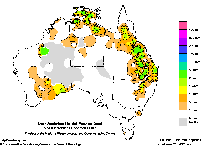
Todays highest rainfall totals for the 24 hours to 9am. It
includes the top 5 totals nationally followed by all reported falls of 50mm or more. |
Highest
and lowest recordings of hours of sunshine for the 24 hours to midnight. |
Highest wind
run totals in kilometres for the 24 hours to 9am (average speed in brackets).
All reported runs >
=25km/h are shown. |
Highest wind
gusts in km/h for the 24 hours to midnight followed by the hour in which it occurred.
All stations with gusts >
89km/h are shown. |
74.8 MIVA Brisbane/SE Coast QLD
69.4 WARKON Maranoa QLD
67.4 BAGSTOWE STATION Upper Carpentaria QLD
67.0 FISHERMANS POCKET TM Brisbane/SE Coast QLD
59.0 MACLEAN BRIDGE ALERT Brisbane/SE Coast QLD
NORTHERN TERRITORY
N Rivers
55.2 HUMPTY DOO COLLARD ROAD
50.0 SHOAL BAY
QUEENSLAND
Upper Carpentaria
67.4 BAGSTOWE STATION
Central Coast W
56.0 ESSEX
Central Highlands
54.0 WOLEEBEE NEVASA
53.0 CAPELLA POST OFFICE
Wide Bay/Burnett
50.0 TANNYMOREL
Brisbane/SE Coast
74.8 MIVA
67.0 FISHERMANS POCKET TM
59.0 MACLEAN BRIDGE ALERT
57.0 MACLEAN BRIDGE
56.0 KENILWORTH TOWNSHIP
54.0 SOUTH MACLEAN WTP
53.0 ZACHARIAH TM
53.0 URANGAN HIBISCUS ST
52.0 RIVERHEADS
51.0 HOME PARK TM
Maranoa
69.4 WARKON
55.0 ST GEORGE AIRPORT
|
13.9 SCONE SCS Hunter Valley NSW
13.7 WAGGA WAGGA AMO SW Slopes S NSW
13.4 WILLIAMTOWN RAAF Hunter Valley NSW
13.3 CANBERRA AIRPORT Goulburn/Monaro NSW
13.2 MOREE AERO NW Plains E NSW
.....
5.4 CEDUNA AMO W Agricultural SA
5.3 DARWIN AIRPORT N Rivers NT
3.6 ADELAIDE (KENT TOWN) Adelaide/Lofty SA
1.3 GILES METEOROLOGICAL OFFICE Interior WA
1.0 ADELAIDE AIRPORT Adelaide/Lofty SA
|
1093 (45.5) VARANUS ISLAND Islands ISL
1055 (44.0) ROTTNEST ISLAND Lower West WA
923 (38.5) BARROW ISLAND AIRPORT W Pilbara WA
922 (38.4) GARDEN ISLAND HSF Lower West WA
889 (37.0) PORT HEDLAND AIRPORT E Pilbara WA
877 (36.5) MAATSUYKER ISLAND LIGHTHOUSE Southeast TAS
875 (36.5) TELFER AERO Interior WA
795 (33.1) CAPE NATURALISTE Lower West WA
785 (32.7) MARDIE W Pilbara WA
767 (32.0) NORTH ISLAND Central West WA
758 (31.6) THEVENARD ISLAND W Pilbara WA
751 (31.3) ROEBOURNE AERO E Pilbara WA
733 (30.5) ONSLOW AIRPORT W Pilbara WA
721 (30.0) GERALDTON AIRPORT Central West WA
716 (29.8) BADGINGARRA RESEARCH STN Lower West WA
709 (29.5) CARNARVON AIRPORT W Gascoyne WA
680 (28.3) LEARMONTH AIRPORT W Pilbara WA
641 (26.7) CAPE LEEUWIN Lower West WA
635 (26.5) PERTH AIRPORT Lower West WA
632 (26.3) SHARK BAY AIRPORT W Gascoyne WA
624 (26.0) MANDURAH Lower West WA
605 (25.2) NORFOLK ISLAND AERO Islands ISL
603 (25.1) BROOME AIRPORT W Kimberley WA
|
118/16 YULARA AERO N Plateau NT
89/21 COOBER PEDY AIRPORT NW Pastoral SA
87/18 GILES METEOROLOGICAL OFFICE Interior WA
85/22 OODNADATTA AIRPORT NE Pastoral SA
85/18 CLEVE AERODROME W Agricultural SA
|
�