|
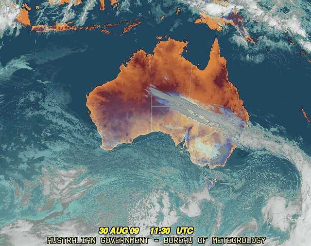
For notes on how to interpret
the data and quality control issues, see Daily Weather Summary Help.
**S** and **W** precede data flagged by the Bureau as suspicious or wrong
Data is as received at 04:53EST, 15/05/2012.
|
|
| |
Max
°
C |
+/- norm
°
C |
Min
°
C |
+/- norm
°
C |
Grass Min
°
C |
Rain to 9am mm |
Evaporation to 9am mm |
Sunshine hours |
Wind Run to 9am km (24-hour average km/h) |
Maximum Gust km/h / hour of occurrence |
| GERALDTON AIRPORT |
18.1 |
-1.9 |
4.0 |
-4.9 |
1.1 |
0.0 |
2.4 |
-- |
332 (13.8) |
30/15 |
| PERTH AIRPORT |
17.1 |
-1.3 |
4.6 |
-3.4 |
4.4 |
0.0 |
2.4 |
4.2 |
284 (11.8) |
30/14 |
| ALBANY AIRPORT |
16.0 |
-0.1 |
8.0 |
+0.5 |
6.6 |
1.0 |
0.8 |
7.6 |
376 (15.7) |
43/12 |
| BUNBURY |
15.8 |
-1.5 |
6.4 |
-1.2 |
-- |
0.0 |
-- |
-- |
124 ( 5.2) |
28/12 |
| MANDURAH |
16.2 |
-- |
10.3 |
-- |
-- |
0.0 |
-- |
-- |
178 ( 7.4) |
21/14 |
| DARWIN AIRPORT |
32.0 |
+0.7 |
23.2 |
+2.8 |
22.8 |
0.0 |
7.0 |
10.2 |
322 (13.4) |
31/12 |
| ALICE SPRINGS AIRPORT |
21.8 |
-0.8 |
14.2 |
+8.2 |
13.5 |
0.0 |
12.6 |
8.6 |
505 (21.0) |
52/10 |
| WHYALLA AERO |
17.3 |
-1.2 |
5.0 |
-0.9 |
-- |
0.0 |
4.2 |
-- |
424 (17.7) |
30/12 |
| ADELAIDE (KENT TOWN) |
15.4 |
-1.3 |
9.2 |
+1.0 |
-- |
15.8 |
-- |
4.3 |
453 (18.9) |
41/00 |
| MOUNT GAMBIER AERO |
13.2 |
-0.9 |
5.4 |
-0.1 |
3.0 |
10.8 |
1.8 |
8.4 |
550 (22.9) |
65/00 |
| MOUNT ISA AERO |
35.0 |
+7.7 |
16.5 |
+6.2 |
15.1 |
0.0 |
7.2 |
9.6 |
222 ( 9.3) |
48/23 |
| CAIRNS AERO |
29.7 |
+3.1 |
18.0 |
+0.6 |
14.6 |
0.0 |
7.4 |
10.6 |
308 (12.8) |
34/13 |
| TOWNSVILLE AERO |
28.5 |
+2.5 |
15.9 |
+1.2 |
14.0 |
0.0 |
6.8 |
10.5 |
247 (10.3) |
34/13 |
| MACKAY M.O |
28.8 |
+6.3 |
16.4 |
+2.4 |
-- |
0.0 |
-- |
10.8 |
264 (11.0) |
39/14 |
| ROCKHAMPTON AERO |
35.1 |
+10.3 |
15.5 |
+4.9 |
13.2 |
0.0 |
6.6 |
-- |
292 (12.2) |
35/12 |
| BUNDABERG AERO |
31.1 |
+7.8 |
19.6 |
+8.7 |
-- |
0.0 |
4.0 |
-- |
582 (24.3) |
37/13 |
| NAMBOUR DPI |
30.0 |
+7.5 |
20.0 |
+12.0 |
-- |
0.0 |
-- |
-- |
-- |
-- |
| COOLANGATTA |
28.3 |
+7.0 |
18.5 |
+8.1 |
-- |
0.0 |
-- |
-- |
484 (20.2) |
31/13 |
| BRISBANE AERO |
31.1 |
+9.3 |
16.5 |
+6.9 |
13.2 |
0.0 |
5.8 |
8.4 |
657 (27.4) |
48/13 |
| TOOWOOMBA AIRPORT |
23.1 |
+4.4 |
17.4 |
+9.9 |
-- |
0.0 |
-- |
-- |
680 (28.3) |
61/10 |
| GUNNEDAH RESOURCE CENTRE |
18.9 |
+1.0 |
13.8 |
+8.0 |
11.8 |
2.0 |
4.6 |
-- |
316 (13.2) |
-- |
| COFFS HARBOUR MO |
25.1 |
+5.3 |
19.3 |
+11.1 |
16.2 |
0.0 |
4.2 |
4.1 |
474 (19.8) |
43/08 |
| PORT MACQUARIE AIRPORT AWS |
24.4 |
+4.2 |
15.2 |
+8.5 |
-- |
0.2 |
-- |
-- |
-- |
-- |
| WILLIAMTOWN RAAF |
21.0 |
+2.4 |
13.8 |
+7.0 |
13.8 |
0.0 |
8.0 |
10.5 |
594 (24.8) |
72/06 |
| GOSFORD (NARARA RESEARCH STATION) AWS |
19.8 |
+0.8 |
13.1 |
+7.8 |
10.8 |
0.8 |
-- |
-- |
160 ( 6.7) |
37/03 |
| ORANGE AGRICULTURAL INSTITUTE |
8.0 |
-3.0 |
2.6 |
+0.5 |
1.4 |
8.4 |
4.2 |
3.8 |
-- |
-- |
| DUBBO AIRPORT AWS |
15.6 |
-1.9 |
9.1 |
+5.7 |
-- |
0.4 |
-- |
-- |
557 (23.2) |
65/02 |
| SYDNEY AIRPORT AMO |
20.1 |
+1.8 |
13.2 |
+5.1 |
11.9 |
0.2 |
9.2 |
10.9 |
753 (31.4) |
70/07 |
| RICHMOND RAAF |
18.6 |
-1.2 |
13.6 |
+9.2 |
11.1 |
0.2 |
-- |
-- |
617 (25.7) |
76/04 |
| BELLAMBI AWS |
17.5 |
-0.5 |
12.1 |
+1.6 |
-- |
0.2 |
-- |
-- |
606 (25.3) |
70/06 |
| CANBERRA AIRPORT |
11.1 |
-1.9 |
5.9 |
+4.9 |
3.3 |
7.6 |
4.2 |
10.2 |
624 (26.0) |
65/03 |
| WAGGA WAGGA AMO |
12.5 |
-2.0 |
6.5 |
+2.9 |
4.3 |
3.4 |
4.2 |
6.7 |
629 (26.2) |
52/00 |
| ALBURY AIRPORT AWS |
11.1 |
-3.9 |
6.3 |
+2.5 |
-- |
13.4 |
-- |
-- |
501 (20.9) |
55/00 |
| MILDURA AIRPORT |
15.0 |
-2.2 |
5.1 |
-0.1 |
2.8 |
0.4 |
3.8 |
5.8 |
492 (20.5) |
37/16 |
| TATURA INST SUSTAINABLE AG |
13.6 |
-1.1 |
3.8 |
-0.1 |
-- |
0.4 |
-- |
-- |
544 (22.7) |
41/03 |
| BENDIGO AIRPORT |
13.3 |
-1.0 |
2.3 |
-0.2 |
-- |
2.8 |
-- |
-- |
404 (16.8) |
�
43/01 |
| MELBOURNE REGIONAL OFFICE |
16.0 |
+1.0 |
6.7 |
0.0 |
3.4 |
4.2 |
1.6 |
-- |
222 ( 9.3) |
30/16 |
| GEELONG AIRPORT |
13.4 |
-1.6 |
4.8 |
-1.1 |
-- |
5.4 |
-- |
-- |
672 (28.0) |
65/02 |
| BALLARAT AERODROME |
11.3 |
-0.1 |
2.0 |
-1.7 |
-- |
10.8 |
-- |
-- |
593 (24.7) |
68/01 |
| LAUNCESTON (TI TREE BEND) |
12.8 |
-0.9 |
4.3 |
+0.7 |
-- |
18.4 |
-- |
-- |
189 ( 7.9) |
48/14 |
| HOBART AIRPORT |
12.3 |
-1.2 |
4.9 |
+0.2 |
0.8 |
9.8 |
0.6 |
7.2 |
381 (15.9) |
59/17 |
| |
Max
°
C |
+/- norm
°
C |
Min
°
C |
+/- norm
°
C |
Grass Min
°
C |
Rain to 9am mm |
Evaporation to 9am mm |
Sunshine hours |
Wind Run to 9am km |
Maximum Gust km/h / hour of occurrence |
|
| Hottest |
| Highest maximum temperature> | Greatest variation above normal maximum |
Highest minimum temperature | Greatest variation above normal minimum |
38.6 ELLIOTT N Plateau NT
38.4 WYNDHAM AERO N Kimberley WA
38.4 WARMUN E Kimberley WA
38.3 TIMBER CREEK N Rivers NT
38.1 VICTORIA RIVER DOWNS N Rivers NT
|
+10.9 : 36.4 MORANBAH WATER TREATMENT PLANT Central Coast W QLD
+10.7 : 36.0 CLERMONT SIRIUS ST Central Highlands QLD
+10.3 : 35.1 ROCKHAMPTON AERO Wide Bay/Burnett QLD
+10.1 : 33.0 MONTO TOWNSHIP Wide Bay/Burnett QLD
+10.0 : 34.0 SPRINGSURE DAME ST Central Highlands QLD
|
27.0 NORTHERN ENDEAVOUR Islands ISL
26.0 TROUGHTON ISLAND N Kimberley WA
25.1 MCCLUER ISLAND N Rivers NT
25.1 DUM IN MIRRIE AWS N Rivers NT
25.0 TRUSCOTT N Kimberley WA
|
+16.1 : 20.0 MITCHELL POST OFFICE Maranoa QLD
+14.4 : 17.6 WARWICK Darling Downs E QLD
+14.0 : 19.6 SURAT Maranoa QLD
+13.9 : 19.0 TAMBO POST OFFICE Central Highlands QLD
+13.8 : 19.2 MILES CONSTANCE STREET Darling Downs W QLD
|
| Coldest |
| Lowest maximum temperature | Greatest variation below normal maximum |
Lowest minimum temperature | Greatest variation below normal minimum |
-1.8 THREDBO AWS Snowy Mtns NSW
-1.5 MT HOTHAM Upper NE VIC
-0.6 FALLS CREEK Upper NE VIC
-0.3 CHARLOTTE PASS (KOSCIUSKO CHALET) Snowy Mtns NSW
-0.3 MOUNT BULLER Upper NE VIC
|
-7.6 : 14.5 OODNADATTA AIRPORT NE Pastoral SA
-7.5 : 13.5 TIBOOBURRA AIRPORT Far Northwest NSW
-7.3 : 13.6 ERNABELLA (PUKATJA) NW Pastoral SA
-6.7 : 15.4 MARLA POLICE STATION NW Pastoral SA
-6.5 : 13.9 TIBOOBURRA POST OFFICE Far Northwest NSW
|
-6.6 MT HOTHAM Upper NE VIC
-6.0 THREDBO AWS Snowy Mtns NSW
-5.8 FALLS CREEK Upper NE VIC
-5.6 MOUNT BULLER Upper NE VIC
|
-5.8 : 1.6 LEINSTER AERO Goldfields WA
-5.7 : -1.7 NORSEMAN AERO Goldfields WA
-5.6 : 0.2 PAYNES FIND E Gascoyne WA
-5.5 : 0.6 MORAWA AIRPORT Central West WA
-5.1 : 0.8 DALWALLINU Central West WA
|
|
Sunniest &
dullest |
Windiest |
Highest gusts |
Todays highest rainfall totals for the 24 hours to 9am. It
includes the top 5 totals nationally followed by all reported falls of 50mm or more. |
Highest
and lowest recordings of hours of sunshine for the 24 hours to midnight. |
Highest wind
run totals in kilometres for the 24 hours to 9am (average speed in brackets).
All reported runs >
=25km/h are shown. |
Highest wind
gusts in km/h for the 24 hours to midnight followed by the hour in which it occurred.
All stations with gusts >
89km/h are shown. |
58.0 PERISHER VALLEY SKI CENTRE Snowy Mtns NSW
52.0 OURNIE (WARALLA) SW Slopes S NSW
44.6 THREDBO VILLAGE Snowy Mtns NSW
37.2 FISH CREEK (HODDLE RANGE) W Gippsland VIC
37.0 ADVENTURE BAY (FORESTRY) Southeast TAS
NEW SOUTH WALES
Snowy Mtns
58.0 PERISHER VALLEY SKI CENTRE
44.6 THREDBO VILLAGE
SW Slopes S
52.0 OURNIE (WARALLA)
VICTORIA
W Gippsland
37.2 FISH CREEK (HODDLE RANGE)
TASMANIA
Southeast
37.0 ADVENTURE BAY (FORESTRY)
|
11.4 BROOME AIRPORT W Kimberley WA
11.3 COBAR MO Upper Darling NSW
11.2 GOVE AIRPORT N Rivers NT
11.0 RABBIT FLAT N Plateau NT
10.9 SYDNEY AIRPORT AMO Sydney--east NSW
.....
3.6 ADELAIDE AIRPORT Adelaide/Lofty SA
1.0 LAKE EILDON N Central VIC
0.0 MOREE AERO NW Plains E NSW
0.0 INVERELL RESEARCH CENTRE N Tablelands W NSW
0.0 STRATHGORDON VILLAGE W Coast TAS
|
1493 (62.2) HOGAN ISLAND Islands ISL
1187 (49.5) NEPTUNE ISLAND W Agricultural SA
1173 (48.9) CAPE GRIM BAPS N Coast TAS
1070 (44.6) WILSONS PROMONTORY LIGHTHOUSE W Gippsland VIC
960 (40.0) FALLS CREEK Upper NE VIC
940 (39.2) CABRAMURRA SMHEA AWS SW Slopes S NSW
933 (38.9) FLINDERS ISLAND AIRPORT Flinders Is/Bass St TAS
924 (38.5) CAPE JAFFA (THE LIMESTONE) Lower SE SA
924 (38.5) MOUNT HOTHAM Upper NE VIC
924 (38.5) LOW HEAD N Coast TAS
915 (38.1) VARANUS ISLAND Islands ISL
901 (37.5) CAPE OTWAY LIGHTHOUSE W Coast VIC
895 (37.3) CAPE MORETON LIGHTHOUSE Brisbane/SE Coast QLD
895 (37.3) MOUNT BOYCE AWS C Tablelands S NSW
888 (37.0) COLAC (MOUNT GELLIBRAND) W Coast VIC
880 (36.7) BARROW ISLAND AIRPORT W Pilbara WA
863 (36.0) CAPE BORDA Yorke Pen/Kanga Is SA
859 (35.8) MAATSUYKER ISLAND LIGHTHOUSE Southeast TAS
858 (35.8) CAPE NELSON LIGHTHOUSE W Coast VIC
855 (35.6) GABO ISLAND LIGHTHOUSE E Gippsland VIC
842 (35.1) PORT FAIRY AWS W Coast VIC
830 (34.6) MURRURUNDI GAP AWS Hunter Valley NSW
827 (34.5) PORTLAND (CASHMORE AIRPORT) W Coast VIC
817 (34.0) MOSS VALE AWS Illawarra NSW
802 (33.4) GOULBURN AIRPORT AWS Goulburn/Monaro NSW
795 (33.1) STENHOUSE BAY Yorke Pen/Kanga Is SA
794 (33.1) THEVENARD ISLAND W Pilbara WA
791 (33.0) MONTAGUE ISLAND LIGHTHOUSE South Coast NSW
784 (32.7) ORANGE AIRPORT AWS C Tablelands S NSW
774 (32.3) KING ISLAND AIRPORT King Island TAS
768 (32.0) MOUNT WELLINGTON Southeast TAS
766 (31.9) GREEN CAPE AWS South Coast NSW
753 (31.4) SYDNEY AIRPORT AMO Sydney--east NSW
747 (31.1) THREDBO AWS Snowy Mtns NSW
744 (31.0) SWAN ISLAND E Coast TAS
743 (31.0) CAPE WILLOUGHBY Yorke Pen/Kanga Is SA
742 (30.9) COULTA (COLES POINT) W Agricultural SA
738 (30.8) ADELAIDE AIRPORT Adelaide/Lofty SA
729 (30.4) COCOS ISLAND AIRPORT Islands ISL
726 (30.3) AVALON AIRPORT W Central VIC
723 (30.1) MELBOURNE AIRPORT E Central VIC
719 (30.0) BALLERA GAS FIELD Far SW QLD
703 (29.3) SCONE AIRPORT AWS Hunter Valley NSW
687 (28.6) THARGOMINDAH AIRPORT Far SW QLD
680 (28.3) TOOWOOMBA AIRPORT Darling Downs E QLD
675 (28.1) OAKEY AERO Darling Downs E QLD
674 (28.1) MOUNT CRAWFORD FIRE TOWER Adelaide/Lofty SA
673 (28.0) CARNARVON AIRPORT W Gascoyne WA
672 (28.0) GROVEDALE (GEELONG AIRPORT) W Central VIC
669 (27.9) EAST SALE AIRPORT W Gippsland VIC
663 (27.6) RUNDLE ISLAND Wide Bay/Burnett QLD
657 (27.4) BRISBANE AERO Brisbane/SE Coast QLD
656 (27.3) CAPE BRUNY (CAPE BRUNY) Southeast TAS
655 (27.3) BRAIDWOOD RACECOURSE AWS South Coast NSW
654 (27.3) EILDON FIRE TOWER N Central VIC
653 (27.2) JERVIS BAY (POINT PERPENDICULAR AWS) Illawarra NSW
650 (27.1) WILLIS ISLAND Islands ISL
648 (27.0) BATHURST AIRPORT AWS C Tablelands S NSW
648 (27.0) BOMBALA AWS Goulburn/Monaro NSW
646 (26.9) LADY ELLIOT ISLAND Wide Bay/Burnett QLD
645 (26.9) SWAN HILL AERODROME Mallee S VIC
642 (26.8) EDINBURGH RAAF Adelaide/Lofty SA
641 (26.7) HINDMARSH ISLAND AWS Adelaide/Lofty SA
637 (26.5) GRIFFITH AIRPORT AWS Riverina W NSW
636 (26.5) ARMIDALE AIRPORT AWS N Tablelands W NSW
636 (26.5) COONABARABRAN AIRPORT AWS CW Slopes N NSW
633 (26.4) DALBY AIRPORT Darling Downs E QLD
629 (26.2) WEST WYALONG AIRPORT AWS CW Plains S NSW
629 (26.2) WAGGA WAGGA AMO SW Slopes S NSW
628 (26.2) DOUBLE ISLAND POINT LIGHTHOUSE Brisbane/SE Coast QLD
625 (26.0) MORWELL (LATROBE VALLEY AIRPORT) W Gippsland VIC
624 (26.0) CANBERRA AIRPORT Goulburn/Monaro NSW
621 (25.9) WANGARATTA AERO Lower NE VIC
620 (25.8) NEWCASTLE NOBBYS SIGNAL STATION AWS Hunter Valley NSW
617 (25.7) MINLATON AERO Yorke Pen/Kanga Is SA
617 (25.7) RICHMOND RAAF Sydney--west NSW
616 (25.7) YANCO AGRICULTURAL INSTITUTE Riverina E NSW
611 (25.5) CONDOBOLIN AIRPORT AWS CW Plains S NSW
611 (25.5) BYRON BAY (CAPE BYRON AWS) North Coast NSW
610 (25.4) CEDUNA AMO W Agricultural SA
608 (25.3) BAIRNSDALE AIRPORT W Gippsland VIC
606 (25.3) BELLAMBI AWS Illawarra NSW
605 (25.2) BADGERYS CREEK AWS Sydney--west NSW
|
120/13 MAATSUYKER ISLAND LIGHTHOUSE Southeast TAS
115/18 MOUNT WELLINGTON Southeast TAS
113/08 HOGAN ISLAND Islands ISL
107/14 CAPE GRIM BAPS N Coast TAS
102/21 WILSONS PROMONTORY LIGHTHOUSE W Gippsland VIC
100/00 CABRAMURRA SMHEA AWS SW Slopes S NSW
98/07 TASMAN ISLAND Southeast TAS
96/17 CAPE BRUNY (CAPE BRUNY) Southeast TAS
94/13 SCOTTS PEAK DAM W Coast TAS
93/09 MOUNT BOYCE AWS C Tablelands S NSW
|
�