Tuesday 19 JUN 2007
 

Home page

DWS ARCHIVE
2024 2023 2022 2021 2020 2019 2018 2017 2016 2015 2014 2013 2012 2011 2010 2009 2008 2007 2006 2005 2004 2003
Before 2003

About the DWS


2007

Dec

M Tu W Th F Sa Su
          01 02
03 04 05 06 07 08 09
10 11 12 13 14 15 16
17 18 19 20 21 22 23
24 25 26 27 28 29 30
31            

Nov

M Tu W Th F Sa Su
      01 02 03 04
05 06 07 08 09 10 11
12 13 14 15 16 17 18
19 20 21 22 23 24 25
26 27 28 29 30    

Oct

M Tu W Th F Sa Su
01 02 03 04 05 06 07
08 09 10 11 12 13 14
15 16 17 18 19 20 21
22 23 24 25 26 27 28
29 30 31        

Sept

M Tu W Th F Sa Su
          01 02
03 04 05 06 07 08 09
10 11 12 13 14 15 16
17 18 19 20 21 22 23
24 25 26 27 28 29 30

August

M Tu W Th F Sa Su
    01 02 03 04 05
06 07 08 09 10 11 12
13 14 15 16 17 18 19
20 21 22 23 24 25 26
27 28 29 30 31    

July

M Tu W Th F Sa Su
            01
02 03 04 05 06 07 08
09 10 11 12 13 14 15
16 17 18 19 20 21 22
23 24 25 26 27 28 29
30 31          

June

M Tu W Th F Sa Su
        01 02 03
04 05 06 07 08 09 10
11 12 13 14 15 16 17
18 19 20 21 22 23 24
25 26 27 28 29 30  

May

M Tu W Th F Sa Su
  01 02 03 04 05 06
07 08 09 10 11 12 13
14 15 16 17 18 19 20
21 22 23 24 25 26 27
28 29 30 31      

April

M Tu W Th F Sa Su
            01
02 03 04 05 06 07 08
09 10 11 12 13 14 15
16 17 18 19 20 21 22
23 24 25 26 27 28 29
30            

March

M Tu W Th F Sa Su
      01 02 03 04
05 06 07 08 09 10 11
12 13 14 15 16 17 18
19 20 21 22 23 24 25
26 27 28 29 30 31  

February

M Tu W Th F Sa Su
      01 02 03 04
05 06 07 08 09 10 11
12 13 14 15 16 17 18
19 20 21 22 23 24 25
26 27 28        

January

M Tu W Th F Sa Su
01 02 03 04 05 06 07
08 09 10 11 12 13 14
15 16 17 18 19 20 21
22 23 24 25 26 27 28
29 30 31        

Monthly summaries:
from BoM

Find a place:
Google Maps |
Aust Gazetteer|
Geonames

Weather terms:
WeatherZone | BoM |
American Met Soc | NOAA | uk.sci.weather | India Meteorological Department

National Daily Weather Summary

Records set | Charts | Cities | Hottest | Coldest | Rain, sun & wind | Downpours & gales
State extremes | Noteworthy weather | Capital Cities | Regional Cities | Alpine Stations
Charts and data courtesy Bureau of Meteorology. MTSAT-1R operated by JMA
Noteworthy weather today
significant newsworthy major

NSW, VIC, QLD, TAS: Storm in teacup as third ECL brings widespread snow, cold and big seas: This event covered in the Daily Weather Summary for 20 June.

WA, NT, QLD, NSW: Extreme cold and wet "dry" season in the north. A look through the records sections in the Daily Weather Summaries for today, 20 June and 21 June shows an enormous slab of the continent experienced its coldest days on record for June and, in many cases, its lowest maximum temperatures ever over these three days. Temperatures on 20 and 21 June were between 12 and 17 below average across about half of tropical Australia. In addition, June rainfall records across the north continue to fall, with dozens broken across the WA Kimberley and NT Top End for the 24 hours to 9am 20 June.

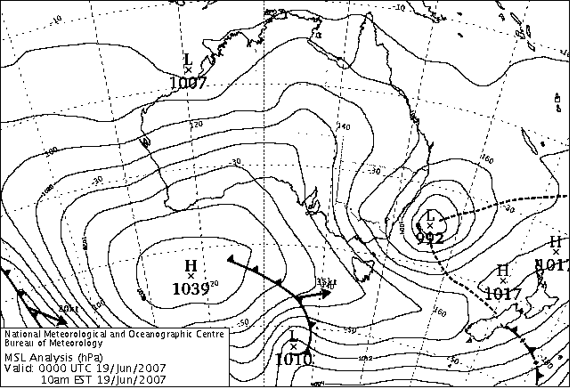
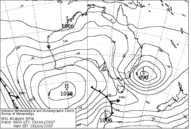
Two interrelated events have produced this extraordinarily widespread event. Low pressure in the Tasman Sea has transported very cold air northwards across SE AUS and into QLD, setting record low daytime temperatures in western NSW today and 20 June. The long wave trough, in which the Tasman low is active, lies across eastern Australia and has forced the sub-tropical jet stream northwards, dragging moisture into tropical AUS from the north and northwest. On 17 June, even low-level winds across the NT and QLD tropics turned northerly, which is very rare in the dry season when the SE Trades blow uninterrupted. This moisture has led to extensive cloud buildup since 15 June, and produced heavy and widespread record winter rainfall across the NT Top End and tropical QLD. The combined effects of an absence of sunshine and the evaporative cooling of rain has produced unheard-of low day-time temperatures across the WA Kimberley and much of the NT and QLD, while it is the invasion of southern air that has produced record cold days in western NSW and southern QLD.

Heavy rain coming in the middle of the dry season has brought unimagined problems in the north. Boggy ground has stopped the first musters of the season, closed roads, stopped supplies and export cattle trucks, and stranded hundreds of tourists in the Kimberley. Mango growers in the Top End are concerned at the effects of the cold on trees about to flower.

Here a just a few of the remarkable events that have made climatic history over this period.

  • Maximum temperatures in NSW today:
    • Cobar Met Office's top of 6.6 was 1.1 below the previous June record in 45 years. If record from an earlier site at Cobar are considered, it was the lowest June maximum temperature in over 100 years.
  • Maximum temperatures in QLD on 20 June:
    • The Monument Airport, 120km SSE of Mt Isa, recorded a 24-hour maximum temperature of 7.7C, believed to be the lowest maximum temperature ever recorded in the tropics in Australia.
    • Applethorpe, in the Granite Belt south of Toowoomba, recorded a top of 4.9C, the lowest maximum temperature ever recorded in the state in June.
    • Boulia's top temperature of 9.0 was its lowest ever recorded in 120 years. The previous record of 9.6 was set on 5 July 1895.
    • 12.5 at Richmond in the Upper Carpentaria shaved half a degree off its lowest June maximum in 113 years.
    • Some locations with 40 to 50 years of climatic history broke their previous all-time records by large margins: Mt Isa (9.4, previous 10.6), Springsure (9.2, 12.0), Tambo (7.3, 10.0), Isisford (10.0, 11.7), Urandangie (8.0, 11.2), Winton (9.6, 12.2), Longreach (8.3, 12.5), and most remarkable of all, Barcaldine (7.8, 12.6).
  • Maximum temperatures in NT on 20 June:
    • Darwin Airport's 22.7 was the city's second lowest maximum on record in 66 years, and broke the lowest June maximum record by 1.5.
    • Larrimah's 14.9 was 2.0 lower than any maximum temperature in 43 years.
    • Katherine Aviation Museum's coldest day in its 26 year history was 23.2 in 1995. Today's top of 22.3 shaved 0.9 off that only to be smashed by a frigid high of 16.5 on 20 June, a further 5.8 below.
    • Tennant Creek's 8.0 was 3.9 below its previous all-time record. The temperature at Tennant Creek stayed below 10C for nearly 40 hours!
  • Maximum temperatures in WA on 20 June:
    • Warmun in the East Kimberley recorded a top of 15.3, 1.5 below its previous all-time record in 45 years .
  • Rainfall, 24 hours to 9am 20 June:
    • Moola Bulla. 20km W of Halls Creek in the Kimberley recorded 40.0mm, its highest June one-day total in 93 years.
    • Victoria River Downs NT recorded 56.4mm, its previous record in 114 years being 20.8mm in 1913.
  • Maximum temperatures in QLD on 21 June:
    • Townsville AP's top of 13.9 was its coldest day in 67 years by 0.7C.
    • Richmond in the Upper Carpentaria knocked a further 1.3C off its 113-year June record set yesterday with a top temperature of 11.2.
    • Locations with between 30 and 55 years of climatic history that broke their previous all-time records by large margins: Croydon (14.6, previous 18.0), Mornington Island (15.2, 16.7), Ayr (12.4, 14.8 in 55 years), Collinsville (11.0, 13.0 in 50 years), Mackay MO (11.8, 13.0).
    • Burketown PO's top of 13.4 was 2.5 lower than any June maximum in 106 years.
  • Wind: The abnormal conditions produced record windiness for June. Darwin set a new record on 20 June, then went one better by breaking its record a second time on 21 June with an average 24-hour wind speed of 25.9km/h.

VIC: Heavy rain brings flooding in Gippsland. Falls of up to 150mm caused flooding and closure of several schools in Central and Eastern Gippsland today. Bairnsdale Secondary College as well as small schools at Tambo Upper, Swan Reach, Clifton Creek, Paynesville and Lindenow all received water damage that closed them for the day. Strong, moist southeasterlies swung onshore by the developing low near the NSW coast brought 156mm to Bairnsdale AP in the 30 hours to 3pm, 74mm falling between 9am and 3pm today. There were many falls of 50-150mm elsewhere in Gippsland (see downpours and wettest for today and tomorrow as well as the Noteworthy Observations page.) The Mt Baw Baw ski fields were a beneficiary, with 80mm falling between 6am and 9pm with the temperature mostly just below zero.

Rain eased mid to late afternoon, but produced minor flooding in the Mitchell, Avon and Macalister Rivers and some tributaries. The Mitchell peaked at Glenaladale on 3.78m at 11.45am Wednesday, at Rosehill on 7.29m late Wednesday, and at Bairnsdale Pump House on 5.28m at 9.30am Thursday, all with minor flooding. The Avon at Stratford peaked about 9am Wednesday on 5.96m, just below moderate level. Minor flooding in the Macalister above Glenmaggie Reservoir gave Licola a peak of 3.3m overnight into Wednesday.

NSW: Brief flooding around Newcastle. Stormwater drains flooded in parts of Newcastle and Lake Macquarie early this morning after 25-35mm of rain fell in a few hours. The rain gave Norah Head its heaviest June fall in 12 years. See downpours.


Records set or equalled today

These records are based on data received as at 0624 EST on 21/08/2008. Help in interpreting these statistics and information on quality control is here.

District Site Today Previous monthly record Previous all time record
if equalled or broken
Comments
Reading Reading Date Years Reading Date Years
Highest daily rainfall

QLD

N Peninsula

027005

COEN POST OFFICE

41.0

36.3

23/06/1914

119

1 y

VIC

E Gippsland

084045

LAKE TYERS

76.6

61.2

11/06/1974

52

1 y

VIC

W Gippsland

085297

MAFFRA

46.6

28.8

24/06/1998

14

1 y

Lowest maximum temperature

WA

N Kimberley

001009

KURI BAY

23.6

24.2

14/06/1973

38

1 Y

WA

N Kimberley

001018

MOUNT ELIZABETH

20.6

21.5

12/06/2000

14

1 Y

WA

E Kimberley

002064

ARGYLE AERODROME

20.0

21.8

13/06/2006

13

21.8

13/06/2006

13

1 Y

WA

W Kimberley

003080

CURTIN AERO

21.5

21.7

18/06/2005

14

1 Y

WA

Interior

013007

BALGO HILLS

13.4

13.4

13/06/1993

21

13.4

02/07/1998

22

1 Y Equal to record.

NT

Darwin-Daly

014142

PIRLANGIMPI

24.6

25.3

22/06/1982

26

25.0

28/07/1986

28

1 Y

NT

Darwin-Daly

014253

CHANNEL POINT

23.1

23.4

12/06/2000

12

23.4

12/06/2000

14

1 Y

NT

Victoria

014829

LAJAMANU

17.6

19.0

13/06/2006

14

1 Y

NT

Darwin-Daly

014903

KATHERINE AVIATION MUSEUM

22.3

23.2

19/06/1995

23

23.2

19/06/1995

26

1 Y

NT

Darwin-Daly

014932

TINDAL RAAF

22.4

22.4

09/06/2000

18

1 Y Equal to record.

NT

Darwin-Daly

014949

DELAMERE WEAPONS RANGE

21.0

21.0

30/06/2000

11

Y Equal to record.

NT

Alice Springs

015666

RABBIT FLAT

14.1

18.0

19/06/2005

11

15.0

02/07/1998

12

1 Y

SA

NE Pastoral

017123

MOOMBA AIRPORT

13.1

14.0

23/06/1998

13

1 Y

NSW

Upper Darling

048027

COBAR MO

6.6

7.7

23/06/1981

46

1 Y

NSW

Upper Darling

048079

WANAARING POST OFFICE

11.9

12.1

24/06/1998

16

1 Y

NSW

Upper Darling

048237

COBAR AIRPORT AWS

6.7

7.9

07/06/2007

13

7.9

07/06/2007

14

1 Y Previous record set earlier this month.

NSW

Southwest Plains

049019

IVANHOE POST OFFICE

8.2

8.3

22/06/1965

48

1 Y

NSW

CW Plains S

050137

CONDOBOLIN AIRPORT AWS

9.2

9.7

29/06/2000

13

1 Y

NSW

Riverina E

074148

NARRANDERA AIRPORT

8.0

8.6

17/06/1981

12

1 P

Highest wind gust (km/h)

NT

Alice Springs

015666

RABBIT FLAT

72

59.0

10/06/2001

11

Y


The day in charts
Surface charts Satellite images Rain & temperatures
4am EST Rainfall -- 24 hours to 9am
Available about 6am EST Available about 4am EST Available about 2pm EST
Week to 9am | SE AUS detail
10am EST Minimum temperature +/- normal
Available about noon EST Available about 10am EST Available about 2pm EST next day
Actual temperatures
4pm EST Maximum temperature +/- normal
Available about 6pm EST Available about 4pm EST Available about 2pm EST next day
Actual temperatures
10pm EST Solar Radiation
Available about midnight EST Available about 10pm EST Available about 2am EST next day

Summary of observations

For notes on how to interpret the data and quality control issues, see Daily Weather Summary Help.
**S** and **W** precede data flagged by the Bureau as suspicious or wrong
Data is as received at 00:47EST, 15/05/2012.

Major centres
Max
° C
+/- norm
° C
Min
° C
+/- norm
° C
Grass Min
° C
Rain to 9am mm Evaporation to 9am mm Sunshine hours Wind Run to 9am km (24-hour average km/h) Maximum Gust km/h / hour of occurrence
GERALDTON AIRPORT 19.1 -1.8 7.8 -3.2 6.0 0.0 6.0 -- 647 (27.0) 58/09
PERTH AIRPORT 15.8 -3.1 9.3 +0.3 6.1 0.0 2.2 6.3 538 (22.4) 50/11
ALBANY AIRPORT 15.4 -1.2 9.8 +1.7 6.4 1.6 1.8 2.6 363 (15.1) 37/10
BUNBURY 18.2 -0.2 7.4 -0.7 -- 0.0 -- -- 309 (12.9) 35/12
MANDURAH 17.0 -- 10.0 -- -- 0.0 -- -- 348 (14.5) 35/11
DARWIN AIRPORT 26.1 -4.5 22.7 +2.8 21.5 0.2 5.2 0.0 331 (13.8) 41/11
ALICE SPRINGS AIRPORT 13.4 -6.4 0.6 -4.5 -2.3 0.0 2.4 7.4 239 (10.0) 41/10
WHYALLA AERO 13.1 -4.2 7.8 +1.7 -- 0.4 3.0 -- 468 (19.5) 41/19
ADELAIDE (KENT TOWN) 13.1 -3.0 3.6 -4.5 2.5 2.8 1.2 8.1 190 ( 7.9) 35/10
MOUNT GAMBIER AERO 12.6 -1.2 3.2 -2.6 0.3 7.4 2.6 8.7 459 (19.1) 48/04
MOUNT ISA AERO 17.1 -7.8 8.8 -1.2 6.4 0.0 2.2 4.9 438 (18.3) 35/12
CAIRNS AERO 24.7 -1.3 19.1 +1.3 18.9 14.4 1.0 0.2 430 (17.9) 34/11
TOWNSVILLE AERO 20.4 -5.2 14.7 +0.1 14.7 26.0 1.0 0.0 227 ( 9.5) 41/13
MACKAY M.O 19.2 -2.7 13.0 -1.0 -- 4.6 -- 0.0 252 (10.5) 26/12
ROCKHAMPTON AERO 21.2 -2.3 14.1 +3.2 13.8 2.6 0.8 -- 200 ( 8.3) 35/14
BUNDABERG AERO 21.0 -1.6 13.3 +1.7 -- 2.4 -- -- 252 (10.5) 37/11
NAMBOUR DPI 20.0 -1.6 9.1 -0.2 -- 0.0 2.4 -- 14 ( 0.6) 37/12
COOLANGATTA 21.7 +0.6 13.2 +1.7 -- 0.0 -- -- 234 ( 9.8) 35/11
BRISBANE AERO 19.4 -1.9 12.8 +2.3 9.0 0.6 2.0 9.5 294 (12.3) 59/12
TOOWOOMBA AIRPORT 12.8 -4.2 7.8 +0.3 -- 0.0 -- -- 460 (19.2) 54/11
GUNNEDAH RESOURCE CENTRE 11.9 -4.9 4.1 -2.0 0.5 13.8 0.8 -- 163 ( 6.8) --
COFFS HARBOUR MO 19.8 +0.4 9.9 +0.8 7.0 7.0 3.0 9.8 185 ( 7.7) 37/13
PORT MACQUARIE AIRPORT AWS 18.8 -0.7 8.1 +0.1 -- 10.0 -- -- -- --
WILLIAMTOWN RAAF 15.2 -2.4 10.3 +2.4 10.1 44.0 0.8 0.5 405 (16.9) 67/23
GOSFORD (NARARA RESEARCH STATION) AWS 13.4 -4.5 10.2 +3.7 -- 23.2 -- -- 167 ( 7.0) 30/22
ORANGE AGRICULTURAL INSTITUTE 12.4 +1.9 2.9 +0.3 1.0 0.8 0.0 1.0 -- --
DUBBO AIRPORT AWS 10.6 -5.8 6.0 +1.4 -- 0.0 -- -- -- --
SYDNEY AIRPORT AMO 13.7 -3.9 9.5 +1.0 9.3 12.2 3.0 0.0 847 (35.3) 68/22
RICHMOND RAAF 13.2 -4.8 8.4 +3.5 -- 10.2 -- -- 258 (10.8) 31/22
BELLAMBI AWS 13.7 -4.0 9.7 -1.3 -- 6.0 -- -- 580 (24.2) 74/19
CANBERRA AIRPORT 9.7 -2.5 2.7 +1.7 1.4 4.6 1.8 0.0 202 ( 8.4) 28/09
WAGGA WAGGA AMO 10.2 -3.6 2.3 -1.4 -0.4 0.2 1.0 1.2 188 ( 7.8) 26/22
ALBURY AIRPORT AWS 10.2 -4.0 3.4 -0.5 -- 0.0 -- -- 172 ( 7.2) 26/04
MILDURA AIRPORT 12.2 -3.8 2.5 -2.7 -0.1 0.0 2.0 4.9 422 (17.6) 50/15
TATURA INST SUSTAINABLE AG 11.8 -2.2 3.9 +0.2 -- 4.8 1.8 -- 486 (20.3) 54/15
BENDIGO AIRPORT 11.1 -2.1 4.5 +0.9 -- 0.0 -- -- 520 (21.7) 63/14
MELBOURNE REGIONAL OFFICE 13.6 -0.4 6.5 -0.4 4.1 0.0 1.0 -- 141 ( 5.9) 21/10
GEELONG AIRPORT 11.6 -3.0 4.9 -1.4 -- 8.6 -- -- 350 (14.6) 63/06
BALLARAT AERODROME 7.8 -3.0 1.4 -2.6 -- 2.0 -- -- 626 (26.1) 65/12
LAUNCESTON (TI TREE BEND) 10.0 -3.1 0.9 -2.0 -- 0.0 -- -- 460 (19.2) 54/11
HOBART AIRPORT 9.4 -3.5 0.9 -3.7 -0.7 4.2 1.0 4.7 296 (12.3) 30/15
Max
° C
+/- norm
° C
Min
° C
+/- norm
° C
Grass Min
° C
Rain to 9am mm Evaporation to 9am mm Sunshine hours Wind Run to 9am km Maximum Gust km/h / hour of occurrence
Hottest
Highest maximum temperature>Greatest variation above normal maximum Highest minimum temperatureGreatest variation above normal minimum

31.0 SCHERGER RAAF N Peninsula QLD
30.9 WEIPA AERO N Peninsula QLD
30.7 OENPELLI N Rivers NT
30.6 COEN AIRPORT N Peninsula QLD
30.1 COCONUT ISLAND N Peninsula QLD

+1.9 : 12.4 ORANGE AGRICULTURAL INSTITUTE C Tablelands S NSW
+1.7 : 27.0 MAREEBA AIRPORT N Coast--Barron QLD
+1.7 : 17.5 PEMBERTON Lower West WA
+1.4 : 26.9 ONSLOW W Pilbara WA
+1.2 : 16.0 GABO ISLAND LIGHTHOUSE E Gippsland VIC

26.1 COCONUT ISLAND N Peninsula QLD
25.0 TROUGHTON ISLAND N Kimberley WA
24.1 WILLIS ISLAND Islands ISL
24.1 BLACK POINT N Rivers NT
24.0 CAPE DON N Rivers NT
24.0 DUM IN MIRRIE AWS N Rivers NT

+8.9 : 18.0 MOUNT ELIZABETH N Kimberley WA
+7.8 : 19.3 DOONGAN N Kimberley WA
+7.6 : 21.7 KALUMBURU N Kimberley WA
+7.3 : 8.2 INVERELL (RAGLAN ST) N Tablelands W NSW
+6.4 : 8.0 BARRABA POST OFFICE NW Slopes N NSW
+6.4 : 20.1 DOUGLAS RIVER N Rivers NT

Coldest
Lowest maximum temperatureGreatest variation below normal maximum Lowest minimum temperatureGreatest variation below normal minimum

-1.2 MT HOTHAM Upper NE VIC
-1.2 MOUNT WELLINGTON Southeast TAS
-0.3 THREDBO AWS Snowy Mtns NSW
-0.3 FALLS CREEK Upper NE VIC
0.0 LIAWENEE Central Plateau TAS
0.0 MOUNT GININI AWS Goulburn/Monaro NSW

-12.7 : 13.4 BALGO HILLS Interior WA
-12.3 : 17.9 FITZROY CROSSING AERO W Kimberley WA
-11.5 : 14.1 RABBIT FLAT N Plateau NT
-10.4 : 6.7 COBAR AIRPORT AWS Upper Darling NSW
-10.0 : 17.3 HALLS CREEK AIRPORT E Kimberley WA

-6.2 LAKE LEAKE (ELIZABETH RIVER) E Coast TAS
-5.9 CHARLOTTE PASS (KOSCIUSKO CHALET) Snowy Mtns NSW
-5.6 MT HOTHAM Upper NE VIC
-5.0 THREDBO AWS Snowy Mtns NSW
-5.0 MELTON MOWBRAY (NORTH STOCKMAN) Southeast TAS

-8.1 : -1.5 ROSEWORTHY AG COLLEGE Adelaide/Lofty SA
-7.4 : -3.2 WYNYARD AIRPORT N Coast TAS
-7.2 : -5.0 MELTON MOWBRAY (NORTH STOCKMAN) Southeast TAS
-7.1 : -0.4 WUDINNA AERO W Agricultural SA
-6.9 : -6.2 LAKE LEAKE (ELIZABETH RIVER) E Coast TAS
-6.9 : -1.0 PADTHAWAY SOUTH Lower SE SA

Wettest
Sunniest & dullest
Windiest
Highest gusts
Todays highest rainfall totals for the 24 hours to 9am. It includes the top 5 totals nationally followed by all reported falls of 50mm or more.
Highest and lowest recordings of hours of sunshine for the 24 hours to midnight.
Highest wind run totals in kilometres for the 24 hours to 9am (average speed in brackets). All reported runs > =25km/h are shown.
Highest wind gusts in km/h for the 24 hours to midnight followed by the hour in which it occurred. All stations with gusts > 89km/h are shown.
111.4 PAYNESVILLE W Gippsland VIC
104.0 WAMBERAL (TERRIGAL MEMORIAL COUNTRY CLUB Hunter Valley NSW
101.4 BAIRNSDALE (MITCHELL RIVER @ ROSEHILL) E Gippsland VIC
99.2 BAIRNSDALE AIRPORT W Gippsland VIC
97.0 MEREWETHER (BURWOOD BEACH WWTP) Hunter Valley NSW

QUEENSLAND
S Peninsula
62.0 KOOLBURRA
N Coast--Barron
74.0 CAPE TRIBULATION STORE

NEW SOUTH WALES
Hunter Valley
104.0 WAMBERAL (TERRIGAL MEMORIAL COUNTRY CLUB
97.0 MEREWETHER (BURWOOD BEACH WWTP)
67.8 AVOCA BEACH BOWLING CLUB
66.0 NEWCASTLE (BLACKSMITHS)
65.8 NORAH HEAD AWS
58.4 NEWCASTLE NOBBYS SIGNAL STATION AWS
55.2 WYEE (RUTLEYS ROAD)
51.8 BELMONT WWTP
Sydney--east
62.6 COLLAROY (LONG REEF GOLF CLUB)
50.4 ROSE BAY (ROYAL SYDNEY GOLF CLUB)

VICTORIA
E Gippsland
101.4 BAIRNSDALE (MITCHELL RIVER @ ROSEHILL)
91.6 METUNG (SUNNYBANK)
87.8 NICHOLSON (YENDALOCK)
77.8 LAKES ENTRANCE (EASTERN BEACH ROAD)
76.6 LAKE TYERS
74.8 NICHOLSON WINERY
68.0 POINT HICKS (LIGHTHOUSE)
62.0 SARSFIELD EAST
56.4 MT NOWA NOWA
50.2 NOWA NOWA
W Gippsland
111.4 PAYNESVILLE
99.2 BAIRNSDALE AIRPORT
82.0 LINDENOW
74.4 FERNBANK (TOWRI)
70.0 MITCHELL RIVER @ GLENALADALE
62.6 MT MOORNAPA
54.6 STRATFORD
51.6 VALENCIA CREEK (LITTLE PLAIN)
50.2 AVON RIVER @ THE CHANNEL

9.8 COFFS HARBOUR MO MidNorth Coast N NSW
9.6 LOXTON RESEARCH CENTRE Murray Valley SA
9.5 BRISBANE AERO Brisbane/SE Coast QLD
9.4 ALSTONVILLE TROPICAL FRUIT RESEARCH STAT North Coast NSW
9.3 NURIOOTPA VITICULTURAL Adelaide/Lofty SA

.....

0.0 DARWIN AIRPORT N Rivers NT
0.0 LARRIMAH N Rivers NT
0.0 RABBIT FLAT N Plateau NT
0.0 TOWNSVILLE AERO N Coast--Herbert QLD
0.0 MACKAY M.O Central Coast E QLD
0.0 SYDNEY AIRPORT AMO Sydney--east NSW
0.0 CANBERRA AIRPORT Goulburn/Monaro NSW
0.0 EAST SALE AIRPORT W Gippsland VIC
0.0 COWRA RESEARCH CENTRE (EVANS ST) C Tablelands S NSW
0.0 KAIRI RESEARCH STATION N Coast--Barron QLD
0.0 SCONE SCS Hunter Valley NSW

1315 (54.8) EDDYSTONE POINT E Coast TAS
1158 (48.3) HOGAN ISLAND Islands ISL
1147 (47.8) CAPE WILLOUGHBY Yorke Pen/Kanga Is SA
1067 (44.5) WILLIS ISLAND Islands ISL
998 (41.6) NEPTUNE ISLAND W Agricultural SA
998 (41.6) WILSONS PROMONTORY LIGHTHOUSE W Gippsland VIC
974 (40.6) SWAN ISLAND E Coast TAS
913 (38.0) MONTAGUE ISLAND LIGHTHOUSE South Coast NSW
912 (38.0) NORTH ISLAND Central West WA
902 (37.6) HINDMARSH ISLAND AWS Adelaide/Lofty SA
891 (37.1) CAPE NELSON LIGHTHOUSE W Coast VIC
878 (36.6) GREEN CAPE AWS South Coast NSW
866 (36.1) STENHOUSE BAY Yorke Pen/Kanga Is SA
847 (35.3) SYDNEY AIRPORT AMO Sydney--east NSW
837 (34.9) CAPE LEEUWIN Lower West WA
813 (33.9) MOUNT BULLER Upper NE VIC
775 (32.3) LOW HEAD N Coast TAS
768 (32.0) PARAWA (SECOND VALLEY FOREST AWS) Adelaide/Lofty SA
751 (31.3) LORD HOWE ISLAND AERO Islands ISL
747 (31.1) CABRAMURRA SMHEA AWS SW Slopes S NSW
740 (30.8) REDESDALE N Central VIC
729 (30.4) EDITHBURGH Yorke Pen/Kanga Is SA
718 (29.9) PORT FAIRY AWS W Coast VIC
710 (29.6) LOW ISLES LIGHTHOUSE N Coast--Barron QLD
701 (29.2) MCCLUER ISLAND N Rivers NT
699 (29.1) CAPE FLATTERY N Coast--Barron QLD
648 (27.0) CAPE OTWAY LIGHTHOUSE W Coast VIC
647 (27.0) GERALDTON AIRPORT Central West WA
642 (26.8) NORFOLK ISLAND AERO Islands ISL
626 (26.1) BALLARAT AERODROME Western Plains VIC
622 (25.9) JERVIS BAY (POINT PERPENDICULAR AWS) Illawarra NSW
611 (25.5) NORTH SHIELDS (PORT LINCOLN AWS) W Agricultural SA
605 (25.2) KILMORE GAP N Central VIC
605 (25.2) CAPE GRIM BAPS N Coast TAS
600 (25.0) DALWALLINU Central West WA
102/23 MONTAGUE ISLAND LIGHTHOUSE South Coast NSW
100/20 FALLS CREEK Upper NE VIC
96/22 GREEN CAPE AWS South Coast NSW
93/09 MOUNT BULLER Upper NE VIC
89/02 EDDYSTONE POINT E Coast TAS

Downpours High AWS wind reports
High rainfall for periods of 6 hours or less from AWS and synoptic reports. Storm force gusts (>89km/h) and 10-minute mean gales (>62km/h) reported by AWSs. Wind direction and mean windspeed are shown in brackets.
NEW SOUTH WALES
Hunter Valley
NEWCASTLE NOBBYS SIGNAL STATION AWS
29.0mm in 3 hr to 00:00 9.7mm/h
WILLIAMTOWN RAAF
19.8mm in 1 hr to 00:00 19.8mm/h
22.0mm in 3 hr to 00:00 7.3mm/h
12.8mm in 1 hr to 00:30 12.8mm/h
NORAH HEAD AWS
11.8mm in 18 min to 00:00 39.3mm/h
12.2mm in 1 hr to 00:00 12.2mm/h
14.4mm in 1 hr to 00:30 14.4mm/h
11.0mm in 11 min to 00:47 60.0mm/h
19.2mm in 1 hr to 01:00 19.2mm/h
35.0mm in 3 hr to 03:00 11.7mm/h
13.6mm in 1 hr to 03:30 13.6mm/h
MURRURUNDI GAP AWS
15.0mm in 3 hr to 00:00 5.0mm/h
Sydney--east
TERREY HILLS AWS
24.0mm in 3 hr to 00:00 8.0mm/h
Illawarra
NOWRA RAN AIR STATION AWS
10.4mm in 1 hr to 23:30 10.4mm/h
JERVIS BAY (POINT PERPENDICULAR AWS)
11.2mm in 1 hr to 22:00 11.2mm/h
South Coast
ULLADULLA AWS
15.0mm in 3 hr to 21:00 5.0mm/h
MERIMBULA AIRPORT AWS
11.4mm in 1 hr to 10:00 11.4mm/h
16.0mm in 3 hr to 12:00 5.3mm/h
VICTORIA
E Gippsland
MALLACOOTA
11.8mm in 1 hr to 04:00 11.8mm/h
24.0mm in 3 hr to 06:00 8.0mm/h
MT NOWA NOWA
15.0mm in 3 hr to 09:00 5.0mm/h
20.0mm in 3 hr to 12:00 6.7mm/h
24.0mm in 3 hr to 15:00 8.0mm/h
15.0mm in 3 hr to 18:00 5.0mm/h
ORBOST
17.0mm in 3 hr to 12:00 5.7mm/h
17.0mm in 3 hr to 18:00 5.7mm/h
W Gippsland
BAIRNSDALE AIRPORT
16.0mm in 3 hr to 03:00 5.3mm/h
10.0mm in 1 hr to 04:00 10.0mm/h
21.0mm in 3 hr to 06:00 7.0mm/h
10.6mm in 1 hr to 08:00 10.6mm/h
14.6mm in 1 hr to 08:30 14.6mm/h
11.4mm in 1 hr to 09:00 11.4mm/h
31.0mm in 3 hr to 09:00 10.3mm/h
11.4mm in 1 hr to 10:30 11.4mm/h
10.2mm in 30 min to 11:00 20.4mm/h
19.6mm in 1 hr to 11:00 19.6mm/h
10.2mm in 30 min to 11:30 20.4mm/h
20.4mm in 1 hr to 11:30 20.4mm/h
18.8mm in 1 hr to 12:00 18.8mm/h
43.0mm in 3 hr to 12:00 14.3mm/h
11.6mm in 1 hr to 12:30 11.6mm/h
MT BAW BAW
17.0mm in 3 hr to 12:00 5.7mm/h
18.0mm in 3 hr to 15:00 6.0mm/h
19.0mm in 3 hr to 18:00 6.3mm/h
16.0mm in 3 hr to 21:00 5.3mm/h
MT MOORNAPA
17.0mm in 3 hr to 09:00 5.7mm/h
11.8mm in 1 hr to 11:30 11.8mm/h
15.6mm in 1 hr to 12:00 15.6mm/h
32.0mm in 3 hr to 12:00 10.7mm/h
14.0mm in 1 hr to 12:30 14.0mm/h
10.4mm in 1 hr to 13:00 10.4mm/h
27.8mm in 2 hr 30 min to 13:30 11.1mm/h
10.0mm in 1 hr to 14:30 10.0mm/h
26.0mm in 3 hr to 15:00 8.7mm/h

SOUTH AUSTRALIA
Yorke Pen/Kanga Is
CAPE WILLOUGHBY : 78(140/ 70 ) at 09:53
NEW SOUTH WALES
South Coast
MONTAGUE ISLAND LIGHTHOUSE : 100(160/ 87 ) at 23:30
GREEN CAPE AWS : 93(180/ 70 ) at 23:04
ULLADULLA AWS : 80(190/ 67 ) at 23:51
VICTORIA
Wimmera S
GRAMPIANS (MOUNT WILLIAM) : 87(170/ 65 ) at 11:30
Upper NE
MOUNT BULLER : 93(160/ 45 ) at 09:07
FALLS CREEK : 96(170/ 74 ) at 21:00
W Gippsland
WILSONS PROMONTORY LIGHTHOUSE : 83(150/ 67 ) at 07:30
KINGFISH A SHIP LOG 206 : 102(153/ 70 ) at 09:50
N Central
REDESDALE : 72(170/ 63 ) at 11:55
TASMANIA
E Coast
EDDYSTONE POINT : 89(160/ 65 ) at 01:08
ISLANDS
Islands
LORD HOWE ISLAND WINDY POINT : 80(280/ 63 ) at 21:00
HOGAN ISLAND : 87(150/ 69 ) at 07:05
LORD HOWE ISLAND AERO : 80(270/ 65 ) at 21:23