|
For notes on how to interpret
the data and quality control issues, see Daily Weather Summary Help.
**S** and **W** precede data flagged by the Bureau as suspicious or wrong
Data is as received at 23:59EST, 14/05/2012.
|
|
| |
Max
°
C |
+/- norm
°
C |
Min
°
C |
+/- norm
°
C |
Grass Min
°
C |
Rain to 9am mm |
Evaporation to 9am mm |
Sunshine hours |
Wind Run to 9am km (24-hour average km/h) |
Maximum Gust km/h / hour of occurrence |
| GERALDTON AIRPORT |
31.7 |
+0.1 |
18.8 |
+0.5 |
17.5 |
0.0 |
10.0 |
-- |
-- |
45/15 |
| PERTH AIRPORT |
41.6 |
+10.0 |
21.5 |
+4.6 |
19.6 |
0.0 |
14.6 |
12.9 |
568 (23.7) |
65/00 |
| ALBANY AIRPORT |
24.4 |
-0.3 |
17.5 |
+3.8 |
16.0 |
0.0 |
10.2 |
12.3 |
638 (26.6) |
58/20 |
| BUNBURY |
38.8 |
+9.4 |
19.1 |
+4.0 |
-- |
0.0 |
-- |
-- |
504 (21.0) |
52/21 |
| MANDURAH |
41.0 |
-- |
21.8 |
-- |
-- |
0.0 |
-- |
-- |
413 (17.2) |
52/21 |
| DARWIN AIRPORT |
34.2 |
+2.4 |
26.1 |
+1.3 |
25.3 |
0.6 |
4.4 |
8.5 |
340 (14.2) |
37/16 |
| ALICE SPRINGS AIRPORT |
32.9 |
-3.5 |
23.4 |
+2.0 |
23.0 |
0.0 |
15.2 |
10.6 |
438 (18.3) |
46/19 |
| WHYALLA AERO |
28.9 |
-1.0 |
20.0 |
+2.6 |
-- |
0.0 |
9.8 |
-- |
222 ( 9.3) |
57/15 |
| ADELAIDE (KENT TOWN) |
29.2 |
+0.1 |
18.7 |
+1.7 |
13.9 |
0.0 |
7.8 |
12.0 |
193 ( 8.0) |
46/13 |
| MOUNT GAMBIER AERO |
22.8 |
-2.4 |
9.0 |
-2.1 |
6.5 |
0.0 |
4.2 |
9.0 |
233 ( 9.7) |
52/22 |
| MOUNT ISA AERO |
33.7 |
-2.6 |
23.3 |
-0.5 |
22.7 |
10.2 |
7.4 |
5.2 |
278 (11.6) |
55/18 |
| CAIRNS AERO |
31.7 |
+0.3 |
24.5 |
+0.8 |
23.0 |
13.8 |
4.2 |
7.2 |
281 (11.7) |
32/03 |
| TOWNSVILLE AERO |
30.8 |
-0.5 |
25.6 |
+1.4 |
23.9 |
0.6 |
4.6 |
9.2 |
314 (13.1) |
34/00 |
| MACKAY M.O |
32.2 |
+2.1 |
23.6 |
+0.1 |
-- |
0.0 |
-- |
11.8 |
222 ( 9.3) |
26/13 |
| ROCKHAMPTON AERO |
32.7 |
+0.8 |
24.9 |
+2.8 |
24.4 |
0.0 |
8.4 |
-- |
289 (12.0) |
39/12 |
| BUNDABERG AERO |
31.2 |
+1.1 |
23.3 |
+1.9 |
-- |
14.0 |
8.5 |
-- |
308 (12.8) |
32/16 |
| NAMBOUR DPI |
31.9 |
+2.6 |
21.3 |
+1.9 |
-- |
4.2 |
-- |
-- |
77 ( 3.2) |
28/13 |
| COOLANGATTA |
29.8 |
+1.7 |
21.8 |
+0.8 |
-- |
18.8 |
-- |
-- |
210 ( 8.8) |
28/11 |
| BRISBANE AERO |
30.2 |
+1.2 |
21.8 |
+0.7 |
22.4 |
33.0 |
9.8 |
9.7 |
374 (15.6) |
35/18 |
| TOOWOOMBA AIRPORT |
30.1 |
+2.0 |
19.5 |
+2.0 |
-- |
6.2 |
-- |
-- |
546 (22.8) |
45/18 |
| GUNNEDAH RESOURCE CENTRE |
35.8 |
+3.9 |
21.5 |
+2.7 |
14.4 |
0.0 |
7.4 |
-- |
175 ( 7.3) |
-- |
| COFFS HARBOUR MO |
28.4 |
+1.5 |
18.1 |
-1.3 |
17.4 |
22.6 |
6.2 |
9.0 |
137 ( 5.7) |
43/14 |
| PORT MACQUARIE AIRPORT AWS |
28.7 |
+1.3 |
18.9 |
+0.8 |
-- |
0.0 |
-- |
-- |
-- |
-- |
| WILLIAMTOWN RAAF |
28.8 |
+0.9 |
20.9 |
+2.9 |
20.6 |
0.2 |
5.0 |
7.6 |
341 (14.2) |
41/17 |
| GOSFORD (NARARA RESEARCH STATION) AWS |
28.1 |
+0.6 |
20.0 |
+3.3 |
-- |
1.0 |
-- |
-- |
90 ( 3.8) |
32/14 |
| ORANGE AGRICULTURAL INSTITUTE |
27.0 |
+0.5 |
10.6 |
-2.6 |
5.4 |
0.0 |
9.6 |
12.8 |
-- |
-- |
| DUBBO AIRPORT AWS |
35.0 |
+1.9 |
14.8 |
-3.3 |
-- |
0.2 |
-- |
-- |
-- |
-- |
| SYDNEY AIRPORT AMO |
28.2 |
+1.8 |
20.0 |
+1.3 |
18.8 |
6.6 |
3.8 |
11.0 |
435 (18.1) |
61/17 |
| RICHMOND RAAF |
32.7 |
+2.9 |
19.4 |
+2.0 |
-- |
0.0 |
-- |
-- |
191 ( 8.0) |
46/16 |
| BELLAMBI AWS |
27.3 |
+2.5 |
18.8 |
-0.1 |
-- |
0.4 |
-- |
-- |
220 ( 9.2) |
57/14 |
| CANBERRA AIRPORT |
31.9 |
+3.9 |
15.2 |
+2.0 |
13.2 |
0.0 |
10.6 |
13.0 |
359 (15.0) |
52/16 |
| WAGGA WAGGA AMO |
33.8 |
+2.2 |
12.1 |
-4.1 |
9.2 |
0.0 |
12.4 |
13.5 |
369 (15.4) |
55/14 |
| ALBURY AIRPORT AWS |
32.9 |
+0.7 |
12.8 |
-3.8 |
-- |
0.0 |
-- |
-- |
272 (11.3) |
57/13 |
| MILDURA AIRPORT |
37.9 |
+5.7 |
17.9 |
+1.3 |
15.4 |
0.0 |
9.6 |
10.7 |
243 (10.1) |
59/18 |
| TATURA INST SUSTAINABLE AG |
32.6 |
+3.1 |
11.5 |
-2.6 |
-- |
0.0 |
-- |
-- |
344 (14.3) |
46/16 |
| BENDIGO AIRPORT |
32.0 |
+2.5 |
10.0 |
-3.9 |
-- |
0.0 |
-- |
-- |
343 (14.3) |
�
50/14 |
| MELBOURNE REGIONAL OFFICE |
26.0 |
+0.1 |
14.0 |
-0.3 |
10.5 |
0.0 |
5.4 |
-- |
120 ( 5.0) |
21/21 |
| GEELONG AIRPORT |
22.8 |
-1.8 |
10.5 |
-2.6 |
-- |
0.0 |
-- |
-- |
253 (10.5) |
44/17 |
| BALLARAT AERODROME |
27.2 |
+2.2 |
8.5 |
-2.3 |
-- |
0.0 |
-- |
-- |
339 (14.1) |
50/13 |
| LAUNCESTON (TI TREE BEND) |
24.0 |
-0.2 |
10.7 |
-1.4 |
-- |
0.0 |
-- |
-- |
229 ( 9.5) |
52/15 |
| HOBART AIRPORT |
22.7 |
+0.2 |
13.5 |
+1.5 |
11.4 |
0.0 |
7.4 |
6.5 |
494 (20.6) |
58/15 |
| |
Max
°
C |
+/- norm
°
C |
Min
°
C |
+/- norm
°
C |
Grass Min
°
C |
Rain to 9am mm |
Evaporation to 9am mm |
Sunshine hours |
Wind Run to 9am km |
Maximum Gust km/h / hour of occurrence |
|
| Hottest |
| Highest maximum temperature> | Greatest variation above normal maximum |
Highest minimum temperature | Greatest variation above normal minimum |
46.6 MARBLE BAR E Pilbara WA
45.4 MORAWA AIRPORT Central West WA
44.2 MULLEWA Central West WA
44.0 BADGINGARRA RESEARCH STN Lower West WA
|
+14.4 : 43.3 LANCELIN Lower West WA
+13.0 : 42.3 SWANBOURNE Lower West WA
+11.8 : 37.1 CAPE NATURALISTE Lower West WA
+11.7 : 37.9 ROTTNEST ISLAND Lower West WA
+11.7 : 42.1 MEDINA RESEARCH CENTRE Lower West WA
|
30.2 WITTENOOM W Pilbara WA
29.5 WULUNGURRU N Plateau NT
29.0 BULGA DOWNS Goldfields WA
29.0 TROUGHTON ISLAND N Kimberley WA
28.9 MEEKATHARRA AIRPORT E Gascoyne WA
|
+8.2 : 25.0 BADGINGARRA RESEARCH STN Lower West WA
+7.9 : 26.3 CARNAMAH Central West WA
+7.5 : 20.0 MOUNT LOFTY Adelaide/Lofty SA
+6.7 : 28.8 YEELIRRIE Goldfields WA
+6.6 : 25.9 MORAWA AIRPORT Central West WA
|
| Coldest |
| Lowest maximum temperature | Greatest variation below normal maximum |
Lowest minimum temperature | Greatest variation below normal minimum |
8.8 MOUNT READ W Coast TAS
11.5 MOUNT WELLINGTON Southeast TAS
12.9 HARTZ MOUNTAIN (KEOGHS PIMPLE) Southeast TAS
13.7 MAATSUYKER ISLAND LIGHTHOUSE Southeast TAS
13.9 SCOTTS PEAK DAM W Coast TAS
|
-8.4 : 25.6 SPRINGSURE DAME ST Central Highlands QLD
-7.9 : 30.7 URANDANGI Northwest QLD
-7.9 : 30.2 WINDORAH POST OFFICE Channel Country QLD
-6.9 : 32.0 BEDOURIE POLICE STATION Channel Country QLD
-6.6 : 13.9 SCOTTS PEAK DAM W Coast TAS
|
2.8 THREDBO VILLAGE Snowy Mtns NSW
3.2 MOUNT WELLINGTON Southeast TAS
4.1 MOUNT READ W Coast TAS
4.5 FINGAL (LEGGE STREET) E Coast TAS
5.4 MT HOTHAM AIRPORT Upper NE VIC
|
-6.3 : 11.0 PARKES AIRPORT AWS CW Slopes S NSW
-5.9 : 14.7 COBAR AIRPORT AWS Upper Darling NSW
-5.9 : 5.7 COLDSTREAM E Central VIC
-5.8 : 12.3 FORBES AIRPORT AWS CW Slopes S NSW
|
|
Sunniest &
dullest |
Windiest |
Highest gusts |
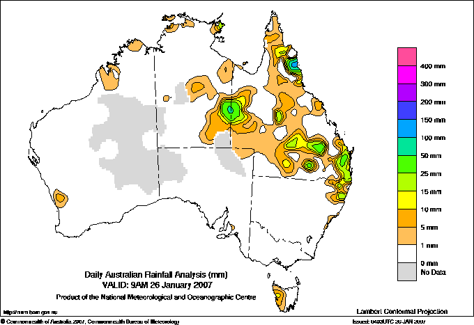
Todays highest rainfall totals for the 24 hours to 9am. It
includes the top 5 totals nationally followed by all reported falls of 50mm or more. |
Highest
and lowest recordings of hours of sunshine for the 24 hours to midnight. |
Highest wind
run totals in kilometres for the 24 hours to 9am (average speed in brackets).
All reported runs >
=25km/h are shown. |
Highest wind
gusts in km/h for the 24 hours to midnight followed by the hour in which it occurred.
All stations with gusts >
89km/h are shown. |
178.0 REEF PARK N Coast--Barron QLD
143.0 MOSSMAN CENTRAL MILL N Coast--Barron QLD
132.4 WHYANBEEL VALLEY N Coast--Barron QLD
130.6 PORT DOUGLAS - WARNER ST N Coast--Barron QLD
127.6 MOSSMAN SOUTH ALCHERA DRIVE N Coast--Barron QLD
QUEENSLAND
Upper Carpentaria
69.2 GEORGETOWN POST OFFICE
N Coast--Barron
178.0 REEF PARK
143.0 MOSSMAN CENTRAL MILL
132.4 WHYANBEEL VALLEY
130.6 PORT DOUGLAS - WARNER ST
127.6 MOSSMAN SOUTH ALCHERA DRIVE
118.4 LOW ISLES LIGHTHOUSE
111.8 CAPE TRIBULATION STORE
108.0 DAINTREE TEA
104.0 DAINTREE VILLAGE
80.0 DEERAL
73.0 COPPERLODE DAM ALERT
Central Coast E
51.0 GIRU NORTH
Central Highlands
68.0 WADDY BRAE
52.0 WADDY BRAE TM
Central West
60.0 LANDSBOROUGH DOWNS
50.0 STRATHDARR
Northwest
103.0 CARANDOTTA STATION
56.6 BUSHY PARK
54.6 CORONA DOWNS
Channel Country
55.0 GLENORMISTON
52.4 ROXBOROUGH DOWNS
Brisbane/SE Coast
69.8 BORUMBA DAM
67.8 KANDANGA TM
66.2 DANEWOOD VALE
65.0 YARRAHAPPINI TM
64.8 WOOLOOGA
64.6 KANDANGA UPPER
63.4 TALLOWOOD
63.0 BLACKBUTT POST OFFICE
61.0 TALLEBUDGERA GUINEAS CK RD
57.0 IMBIL POST OFFICE
56.0 HOME PARK TM
55.6 REDGATE
55.4 LINDFIELD
55.4 LINVILLE
53.0 CANNON COVE TM
52.0 MACLEAN BRIDGE ALERT
51.4 ELANORA WATER TREAT
50.0 IMBIL TM
Darling Downs W
55.0 WOMBALANO
Maranoa
57.0 FOREST VALE
NEW SOUTH WALES
North Coast
66.0 TYALGUM (PUMPENBIL ROAD)
|
13.5 WAGGA WAGGA AMO SW Slopes S NSW
13.1 GILES METEOROLOGICAL OFFICE Interior WA
13.0 NURIOOTPA VITICULTURAL Adelaide/Lofty SA
13.0 CANBERRA AIRPORT Goulburn/Monaro NSW
12.9 PERTH AIRPORT Lower West WA
12.9 WOOMERA AERODROME NW Pastoral SA
.....
3.5 KAIRI RESEARCH STATION N Coast--Barron QLD
3.2 BRIAN PASTURES Brisbane/SE Coast QLD
2.0 WALKAMIN DPI N Coast--Barron QLD
1.5 STRATHGORDON VILLAGE W Coast TAS
0.0 WARWICK Darling Downs E QLD
|
1436 (59.8) MAATSUYKER ISLAND LIGHTHOUSE Southeast TAS
1088 (45.3) CAPE LEEUWIN Lower West WA
986 (41.1) FLINDERS ISLAND AIRPORT Flinders Is/Bass St TAS
914 (38.1) LOW HEAD N Coast TAS
902 (37.6) HOGAN ISLAND Islands ISL
882 (36.8) HARTZ MOUNTAIN (KEOGHS PIMPLE) Southeast TAS
842 (35.1) MOUNT WELLINGTON Southeast TAS
807 (33.6) SCOTTS PEAK DAM W Coast TAS
805 (33.5) SWAN ISLAND E Coast TAS
762 (31.8) VARANUS ISLAND Islands ISL
760 (31.7) CAPE GRIM BAPS N Coast TAS
754 (31.4) PORT HEDLAND AIRPORT E Pilbara WA
752 (31.3) KARRATHA AERO E Pilbara WA
704 (29.3) ROTTNEST ISLAND Lower West WA
672 (28.0) GREEN CAPE AWS South Coast NSW
656 (27.3) WILSONS PROMONTORY LIGHTHOUSE W Gippsland VIC
640 (26.7) BARROW ISLAND AIRPORT W Pilbara WA
638 (26.6) ALBANY AIRPORT Lower West WA
637 (26.5) MOUNT READ W Coast TAS
620 (25.8) CAPE NATURALISTE Lower West WA
613 (25.5) ROEBOURNE AERO E Pilbara WA
611 (25.5) LAVERTON AERO Goldfields WA
606 (25.3) CARNARVON AIRPORT W Gascoyne WA
600 (25.0) CAPE BRUNY (CAPE BRUNY) Southeast TAS
|
95/13 MAATSUYKER ISLAND LIGHTHOUSE Southeast TAS
94/11 HARTZ MOUNTAIN (KEOGHS PIMPLE) Southeast TAS
93/21 GINGIN AERO Lower West WA
87/19 MOUNT WELLINGTON Southeast TAS
85/17 UNIVERSITY OF QUEENSLAND GATTON Brisbane/SE Coast QLD
|
�